-
 Justus Perthes, Ethnographic Map of the Caucasus, 1880£ 245.00
 -
Royal Geographical Society (RGS), Sketch of the Jebel Shammar, 1880£ 175.00
-
Thomas Sulman, Regent Street from Waterloo Place to Portland Place, 1880£ 185.00
-
Richard Anthony Proctor, Constellations of the Southern Hemisphere, 1880£ 475.00
-
Royal Geographical Society (RGS), Map of Northern & Central Arabia, 1880£ 225.00
-
Justus Perthes, Angola and the Congo, 1880£ 88.00
-
Justus Perthes, Texas, 1880£ 175.00
-
W. & A.K. Johnston, Himalaya, 1880 (c.)£ 72.00
-
-
Walter Blackie, Arabia, Red Sea, and Persian Gulf , 1880 (c.)£ 445.00
-
George W. Bacon, Greenwich & Blackheath, 1880 (c.)£ 475.00
-
Ordnance Survey, Cornwall - Padstow to Camelford, 1880 (c.)£ 145.00
-
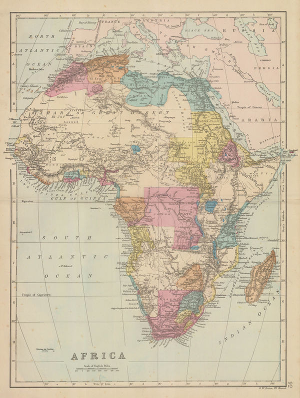
George W. Bacon, Africa, 1880 (c.)£ 195.00
-
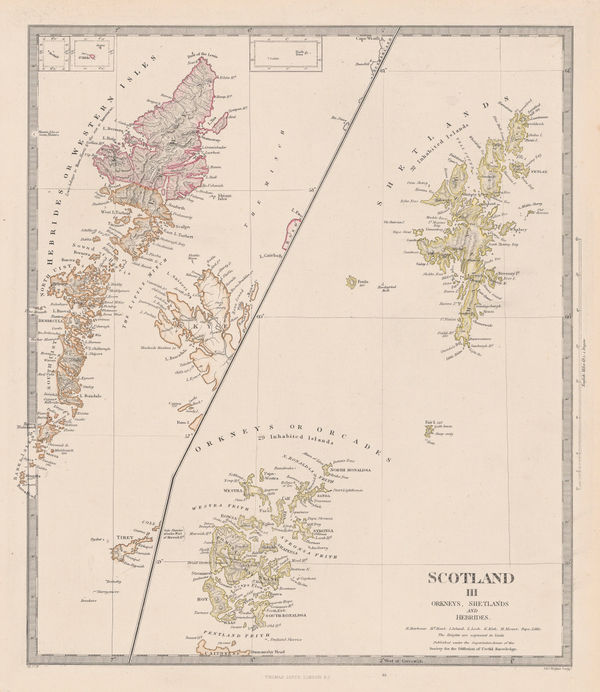
Letts & Son, Orkney, Shetland & Hebrides, 1880 (c.)£ 185.00
-
George W. Bacon, The Mediterranean Sea, 1880 (c.)£ 295.00
-
W. & A.K. Johnston, Wisconsin, 1880 (c.)£ 65.00
-
W. & A.K. Johnston, Tennessee, 1880 (c.)£ 65.00
-
W. & A.K. Johnston, Vermont, 1880 (c.)£ 75.00
-
W. & A.K. Johnston, Minnesota, 1880 (c.)£ 85.00
-
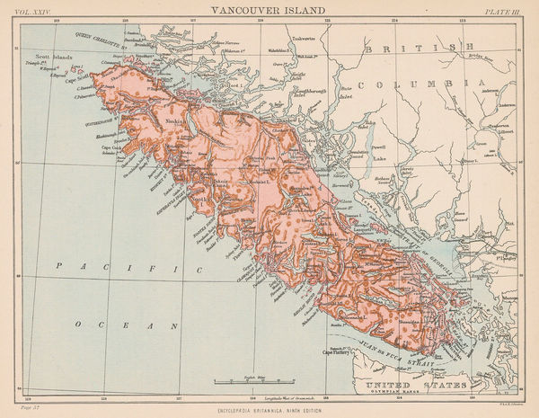
W. & A.K. Johnston, Vancouver Island, 1880 (c.)£ 95.00
-
Ordnance Survey, Bath & Chippenham (Sheet 265), 1880 (c.)£ 125.00
-
Gall & Inglis, Cruchley's Handy Map of London, 1880 c£ 545.00
-
Justus Perthes, The Alps, 1880 c£ 175.00
-
W. & A.K. Johnston, Haiti & the Dominican Republic, 1880 c£ 45.00
-
George W. Bacon, Woolwich, Plumstead, Charlton, Eltham, 1880 c£ 175.00
-
W. & A.K. Johnston, The Middle East, 1880 c£ 75.00
-
W. & A.K. Johnston, Persia, 1880 c£ 75.00
-
W. & A.K. Johnston, Ancient Persia, 1880 c£ 75.00
-
W. & A.K. Johnston, The Levant, 1880 c£ 75.00
-
A. & C. Black, The World on Mercator's Projection, 1880 c£ 395.00
-
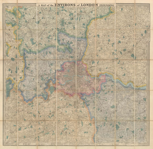
A Map of the Environs of London Extending Twenty Five Miles fr. the Metropolis, 1880 c.Edward StanfordSeries: LondonEdward Stanford, A Map of the Environs of London Extending Twenty Five Miles fr. the Metropolis, 1880 c.£ 825.00
-
A. & C. Black, Australia, 1880 c.£ 295.00
-
W. & A.K. Johnston, California, 1880 c.£ 95.00
-
A. & C. Black, China, 1880 c.£ 225.00
-
Henry George Collins, Collins' Standard Map of London, 1880 c.£ 785.00
-
J. & C. Walker, Cornwall, 1880 c.£ 125.00
-
Society for the Diffusion of Useful Knowledge (SDUK), Dominion of Canada, 1880 c.£ 345.00
-
-
J. van Voorst, Geological Map of Surrey, 1880 c.£ 485.00
-
Ordnance Survey, Index to the Ordnance Survey of the County of Surrey., 1880 c.£ 350.00
-
-
Archibald Fullarton, Nigeria, Cameroon & Chad, 1880 c.£ 30.00
-
-
Frederick Dangerfield & Co., Natal, 1880 c.£ 575.00
-
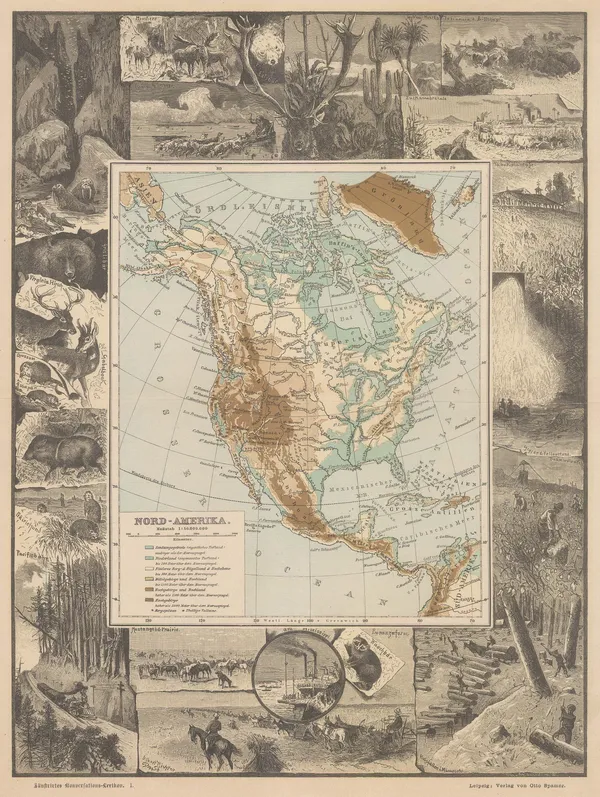
Otto Spamer, North America showing elevations, 1880 c.£ 145.00
-
Gall & Inglis, Reduced Ordnance Map of London, 1880 c.£ 945.00
-
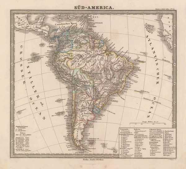
Justus Perthes, South America, 1880 c.£ 45.00
-
Blackie & Son, The Austrian Empire, 1880 c.£ 80.00
-
Blackie & Son, The United States of North America, 1880 c.£ 125.00
-
Walter Blackie, West Indies and Central America, 1880 c.£ 125.00
-
Pettitt & Cox, The Wimbledon House Estate, 1880 c.£ 545.00
-
Thomas Elders' Expedition across Australia from Perth to Beltana, 1880 c.Justus PerthesSeries: GothaJustus Perthes, Thomas Elders' Expedition across Australia from Perth to Beltana, 1880 c.£ 185.00
-
George W. Bacon, Clapham, Wandsworth & Battersea, 1880 c.£ 750.00
-
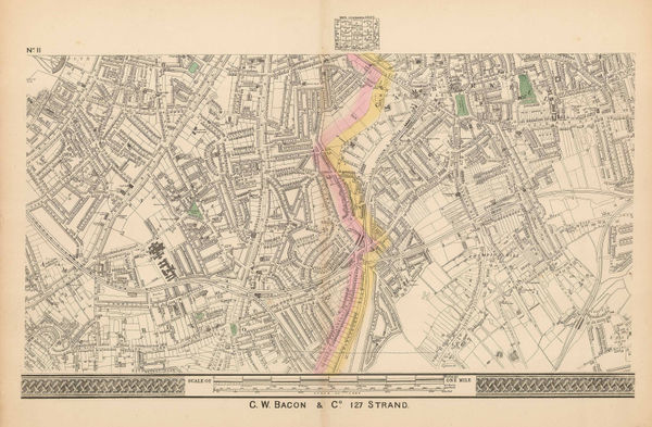
George W. Bacon, [Cricklewood & Willesden Green], 1880 c.£ 160.00
-
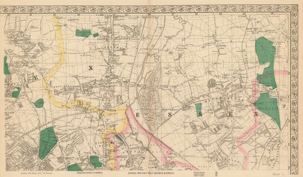
George W. Bacon, Finsbury Park, Crouch End, Tottenham, Leyton & Walthamstow, 1880 c.£ 365.00
-
George W. Bacon, Fulham & Putney, 1880 c.£ 795.00
-
George W. Bacon, Peckham, New Cross, Nunhead & Deptford, 1880 c.£ 295.00
-
George W. Bacon, Stockwell, Brixton & Camberwell, 1880 c.£ 295.00
-
George W. Bacon, Stratford, West Ham & Leytonstone, 1880 c.£ 325.00
-
W. & A.K. Johnston, Iceland, 1880 c.£ 125.00
-
W. & A.K. Johnston, Cornwall, 1880 c.£ 65.00
-
George W. Bacon, London (North Sheet), 1880 c.£ 825.00
-
George W. Bacon, Iceland, Greenland, and the Faroe Islands, 1880 c.£ 175.00
-
Cassell & Company, New York and Environs, 1880 c.£ 82.00
-
W. & A.K. Johnston, Paris, 1880 c.£ 115.00
-
George W. Bacon, Bacon's Map of the Environs of London, 1880 c.£ 445.00
-
W. & A.K. Johnston, Arabia, 1880 c.£ 125.00
-
George W. Bacon, Wimbledon, Merton, Balham, Tooting & Streatham, 1880 c.£ 895.00
-
George W. Bacon, Dulwich, Norwood, Crystal Palace, Penge & Hither Green, 1880 c.£ 325.00
-
George W. Bacon, Bromley, Poplar, Blackwall, Canning Town & North Greenwich, 1880 c.£ 225.00
-
George W. Bacon, East London, 1880 c.£ 545.00
-
Arthème Fayard, New York, 1880 c.£ 275.00
-
W. & A.K. Johnston, Africa, 1880 c.£ 85.00
-
George W. Bacon, Victoria Park, Hackney, Dalston & London Fields, 1880 c.£ 675.00
-
John Dower, China and Japan, 1880 c.£ 195.00
-
George Bradshaw, Vienna, 1880 c.£ 195.00
-
British Admiralty, Banka and Gaspar Straits, 1881£ 595.00
-
British Admiralty, Bay of Biscay, 1881£ 950.00
-
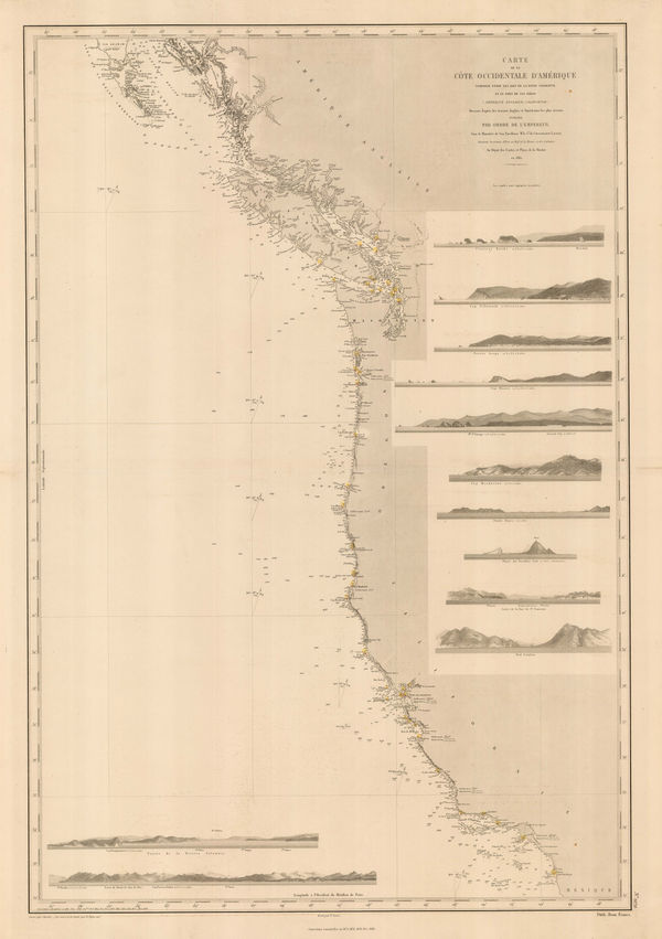
French Admiralty, Chart of the west coast of North America, 1881£ 825.00
-
Letts & Son, Continent of Asia , 1881£ 72.00


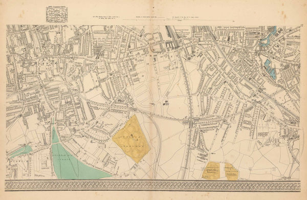
![George W. Bacon, [Cricklewood & Willesden Green], 1880 c.](https://static-assets.artlogic.net/w_600,c_limit,f_auto,fl_lossy,q_auto/artlogicstorage/themaphouse/images/view/cf53116b3099c7da6fc4c3e03a263439j/themaphouse-george-w.-bacon-cricklewood-willesden-green-1880-c..jpg)


Page
89
of 130