-
 George W. Bacon, Hastings and St. Leonards, 1895£ 85.00
 -
W. & A.K. Johnston, Railway Map of England and Wales, 1895£ 795.00
-
Justus Perthes, Geological Map of Southeast Iceland, 1895£ 78.00
-
D. Appleton & Company, Montreal, 1895£ 75.00
-
George W. Bacon, Cornwall, 1895£ 115.00
-
George Philip & Son Ltd., Lincolnshire, 1895£ 55.00
-
Map to Illustrate the Paper on Chitral and Adjacent Countries, 1895Royal Geographical Society (RGS)Series: LondonRoyal Geographical Society (RGS), Map to Illustrate the Paper on Chitral and Adjacent Countries, 1895£ 425.00
-
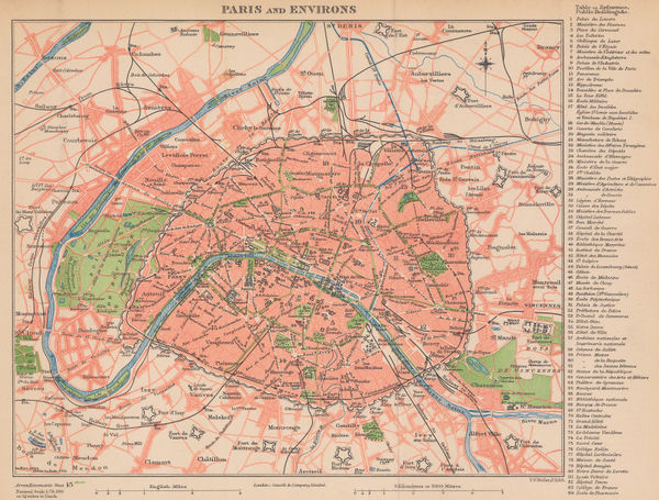
Cassell & Co., Paris and Environs, 1895 (c.)£ 78.00
-
George W. Bacon, The Environs of Dundee, 1895 (c.)£ 65.00
-
George W. Bacon, The Mediterranean Sea, 1895 (c.)£ 295.00
-
George W. Bacon, Tunbridge Wells, 1895 (c.)£ 225.00
-
William Collins, The Moon, 1895 c£ 68.00
-
W. & A.K. Johnston, Texas and Indian Territory, 1895 c£ 85.00
-
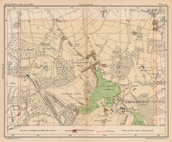
George Philip & Son Ltd., Chislehurst & Elmstead, 1895 c.£ 38.00
-
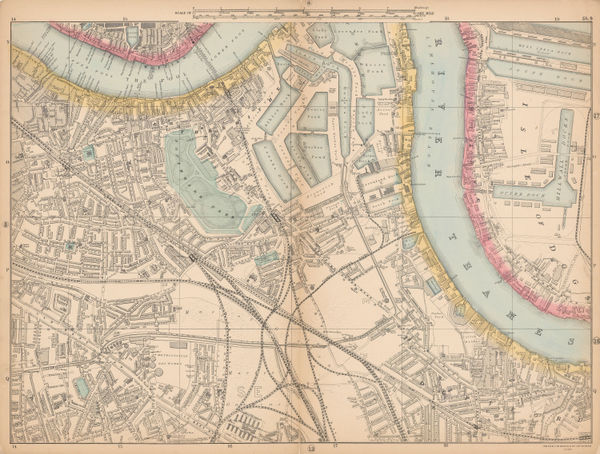
George W. Bacon, Bermondsey, Rotherhithe, Isle of Dogs & Deptford, 1895 c.£ 195.00
-
John Bartholomew & Co., London, 1895 c.£ 98.00
-
George Philip & Son Ltd., The County of Essex, 1895 c.£ 50.00
-
George W. Bacon, Plan of Glasgow, 1895 c.£ 295.00
-
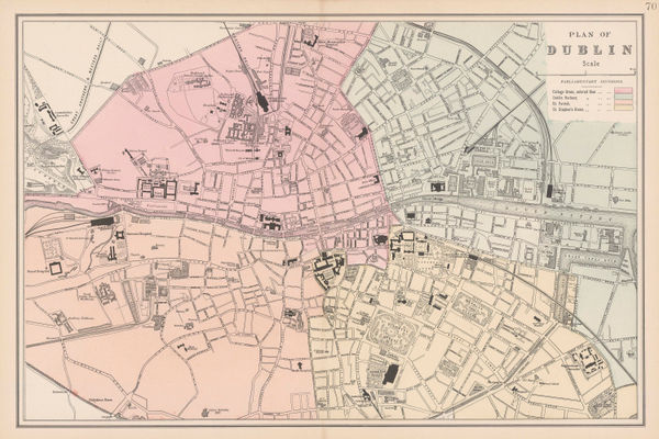
George W. Bacon, Plan of Dublin, 1895 c.£ 175.00
-
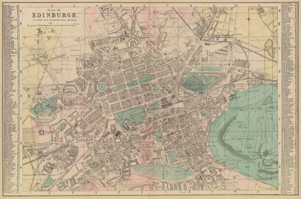
George W. Bacon, Plan of Edinburgh, 1895 c.£ 285.00
-
George W. Bacon, Wimbledon, Merton & Earlsfield, 1895 c.£ 445.00
-
Edward Stanford, Eastern half of Australia, 1896£ 145.00
-
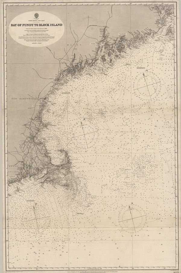
British Admiralty, Bay of Fundy to Block Island, 1896£ 2,150.00
-
Justus Perthes, Lop-Nor basin, north west China, 1896£ 62.00
-
Sir Archibald Geikie, Geological Map of the British Isles, 1896£ 4,000.00
-
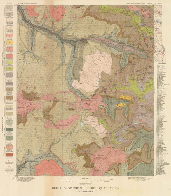
Geology of the Telluride Quadrangle Colorado, 1896United States Geological Survey (USGS)Series: New YorkUnited States Geological Survey (USGS), Geology of the Telluride Quadrangle Colorado, 1896£ 495.00
-
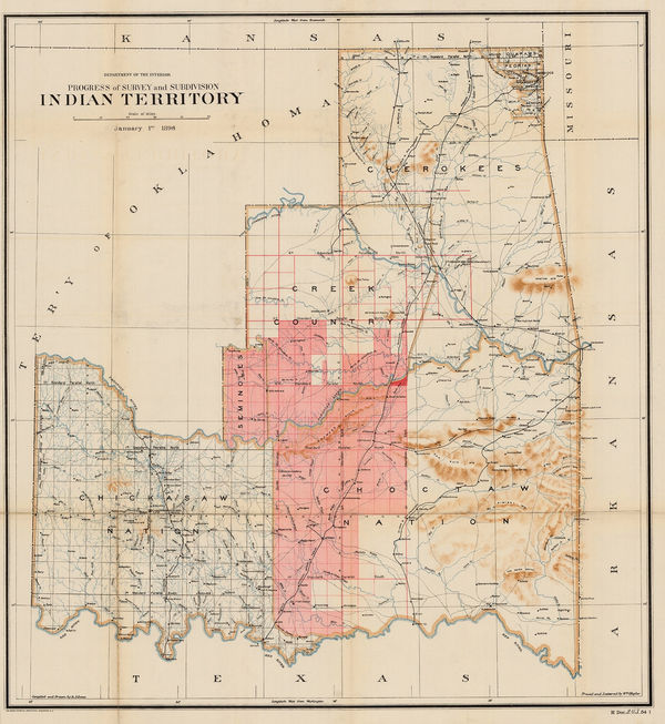
US Department of the Interior, Indian Territory, 1896£ 685.00
-
Justus Perthes, Lower Syr Darya River, Kazakhstan, 1896£ 65.00
-
Royal Geographical Society (RGS), Central and northern Thailand, 1896£ 225.00
-
Scottish Geographical Society (SGS), Hausaland, Nigeria, 1896£ 345.00
-
George Philip & Son Ltd., Russia, 1896£ 38.00
-
Royal Geographical Society (RGS), Sketch Map of the Upper Euphrates in Turkey, 1896£ 245.00
-
Sketch Map of the Malay States, Kelantan & Trengganu, 1896Royal Geographical Society (RGS)Series: LondonRoyal Geographical Society (RGS), Sketch Map of the Malay States, Kelantan & Trengganu, 1896£ 245.00
-
Royal Geographical Society (RGS), Sketch Map of the Wadi Tyin in Oman, 1896£ 245.00
-
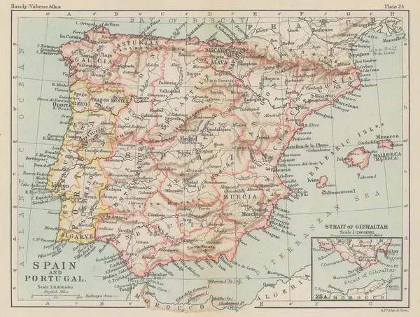
George Philip & Son Ltd., Miniature map of Spain and Portugal, 1896£ 28.00
-
Edward Stanford, The Channel Islands, 1896£ 75.00
-
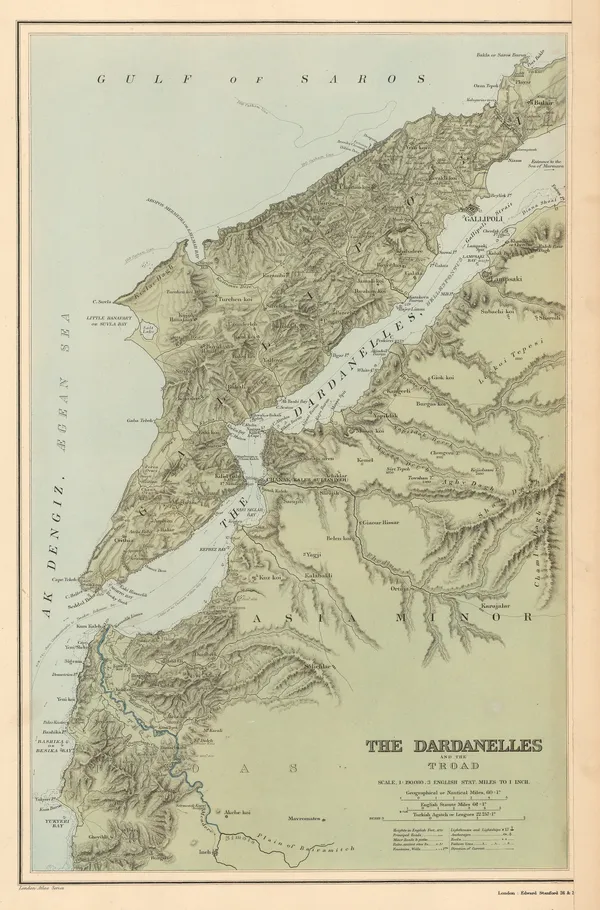
Edward Stanford, The Dardanelles and the Troad, 1896£ 145.00
-
The Pamirs and Adjoining Territories of Central Asia and India, 1896Royal Geographical Society (RGS)Series: LondonRoyal Geographical Society (RGS), The Pamirs and Adjoining Territories of Central Asia and India, 1896£ 475.00
-
Royal Geographical Society (RGS), The Valley of Mexico, 1896£ 145.00
-
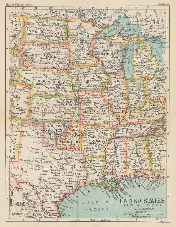
George Philip & Son Ltd., United States - Central Division, 1896£ 36.00
-
George Philip & Son Ltd., United States - Eastern Division, 1896£ 38.00
-
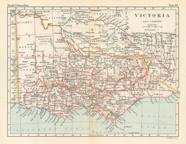
George Philip & Son Ltd., Victoria, 1896£ 38.00
-
John Bartholomew & Co., Isle of Dogs, Poplar, Deptford & Rotherhithe, 1896£ 72.00
-
Edward Stanford, Australia and Tasmania, 1896£ 95.00
-
Edward Stanford, Map of the Countries Around the North Pole, 1896£ 895.00
-
Richard Anthony Proctor, MAP VII., 1896£ 95.00
-
Justus Perthes, Mt Kenya to Mt Kilimanjaro, 1896£ 195.00
-
Edward Stanford, India, 1896£ 175.00
-
General Land Office (GLO), Territory of Arizona, 1896£ 950.00
-
Edward Stanford, Tasmania, 1896£ 85.00
-
Edward Stanford, Western United States, 1896£ 125.00
-
Edward Stanford, West Indies and Central America, 1896£ 95.00
-
Edward Stanford, Ontario, Quebec, New Brunswick & Nova Scotia, 1896£ 95.00
-
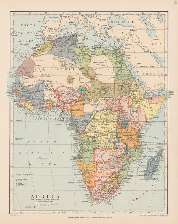
Edward Stanford, Africa, 1896£ 145.00
-
Edward Stanford, Canada, 1896£ 85.00
-
Richard Anthony Proctor, Stars for May & June, 1896£ 95.00
-
Edwin Munroe Bacon, Map of the Country Southeast of Boston, 1896£ 195.00
-
Edwin Munroe Bacon, Map of the Country Northeast of Boston, 1896£ 195.00
-
Edward Stanford, Central Asia, 1896£ 285.00
-
A Map of parts of Gharian, Tarhuna, and M'Salata (Tripoli), 1897Royal Geographical Society (RGS)Series: LondonRoyal Geographical Society (RGS), A Map of parts of Gharian, Tarhuna, and M'Salata (Tripoli), 1897£ 345.00
-
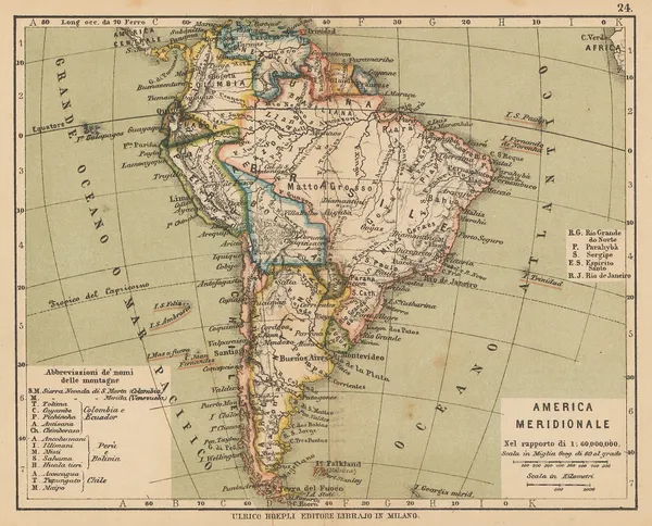
Ulrico Hoepli, South America after the War of the Pacific, 1897£ 36.00
-
Ulrico Hoepli, Miniature map of North America, 1897£ 44.00
-
George Cram, Arkansas, 1897£ 185.00
-
George Cram, California and Nevada Northern Half, 1897£ 225.00
-
Royal Geographical Society (RGS), Phlegraean Fields, 1897£ 345.00
-
Scottish Geographical Society (SGS), Chart of North Polar Regions, 1897£ 595.00
-
Commercial Railroad and County Map of Massachusetts and Rhode Island, 1897George CramSeries: ChicagoGeorge Cram, Commercial Railroad and County Map of Massachusetts and Rhode Island, 1897£ 275.00
-
Royal Geographical Society (RGS), Costa Rica, 1897£ 395.00
-
W. & A.K. Johnston, Folding wall map of North America, 1897£ 1,950.00
-
George Cram, Illinois, 1897£ 245.00
-
George Cram, Indiana, 1897£ 185.00
-
George Cram, Kansas, 1897£ 195.00
-
Istanbul (Constantinople) and the Bosphorus, 1897Wilhelm Leopold Colmar Freiherr von der GoltzSeries: BerlinWilhelm Leopold Colmar Freiherr von der Goltz, Istanbul (Constantinople) and the Bosphorus, 1897£ 885.00
-
Justus Perthes, Tierra del Fuego and the Magellan Straits, 1897£ 95.00
-
George Cram, Kentucky and Tennessee, 1897£ 185.00
-
George Cram, Kentucky Tennessee, 1897£ 195.00
-
George Cram, Maine, 1897£ 225.00
-
Royal Geographical Society (RGS), Zambia & Victoria Falls, 1897£ 145.00
-
Scottish Geographical Society (SGS), Mt. Tarawera and Lake Rotomahana, 1897£ 68.00
-
Royal Geographical Society (RGS), Map of the Niger Delta, 1897£ 645.00


Page
101
of 131