-
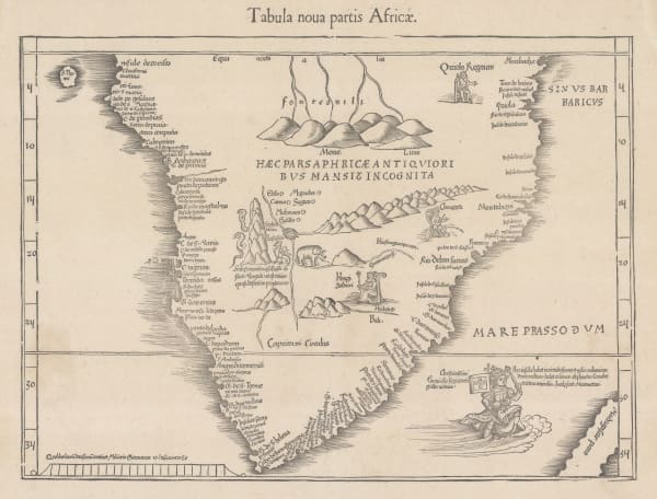
 Martin Waldseemüller & Laurent Fries, The Second Printed Map of Southern Africa, 1541£ 4,950.00
 -
Alain Manesson Mallet, East Africa, 1683£ 295.00
-
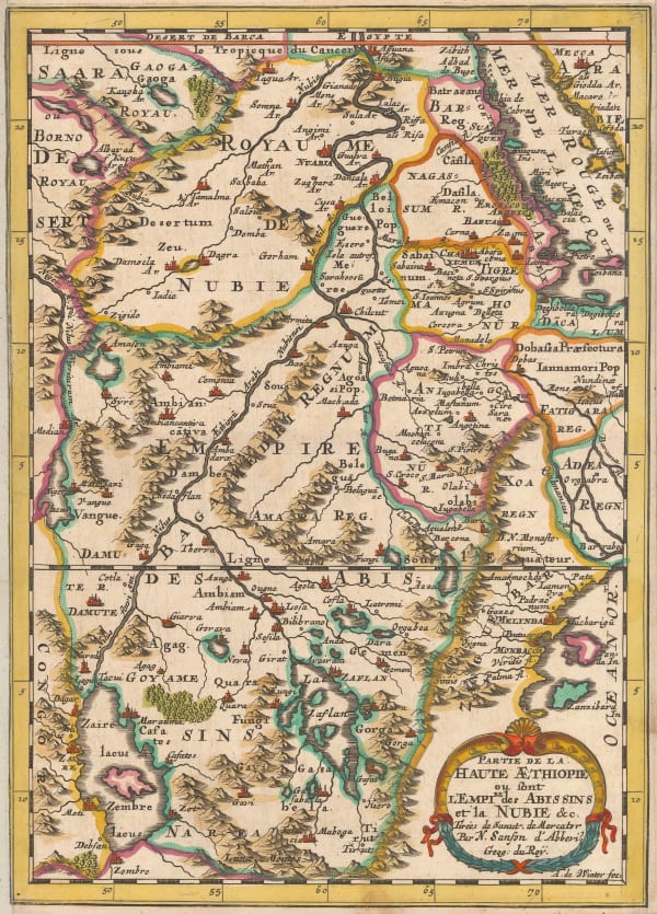
Nicolas & Guillaume Sanson, Ethiopia & Nubia, 1692£ 245.00
-
Pierre Duval, Ethiopia & Sudan, 1694£ 225.00
-
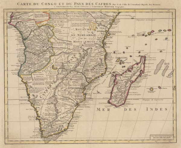
Covens (Jean) & Mortier (Cornelius), Southern & Central Africa, 1730 c.£ 1,250.00
-
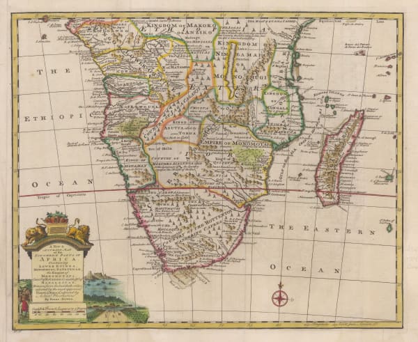
Emanuel Bowen, A New & Accurate Map of the Southern Parts of Africa, 1747£ 695.00
-
Charles Francois Delamarche, Southern & Central Africa, 1795£ 325.00
-
Adrien Brue, Southern Africa & the Cape Colony, 1828 c.£ 250.00
-
Justus Perthes, Kenya and Tanzania, 1856£ 595.00
-
Royal Geographical Society (RGS), Burton & Speke's exploratory route in Tanzania, 1859£ 195.00
-
Justus Perthes, Speke's journey to Lake Victoria, 1859£ 175.00
-
Joseph Hutchins Colton, Southern Africa, 1861£ 165.00
-
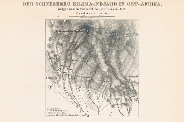
Justus Perthes, Mt Kilimanjaro, 1864£ 95.00
-
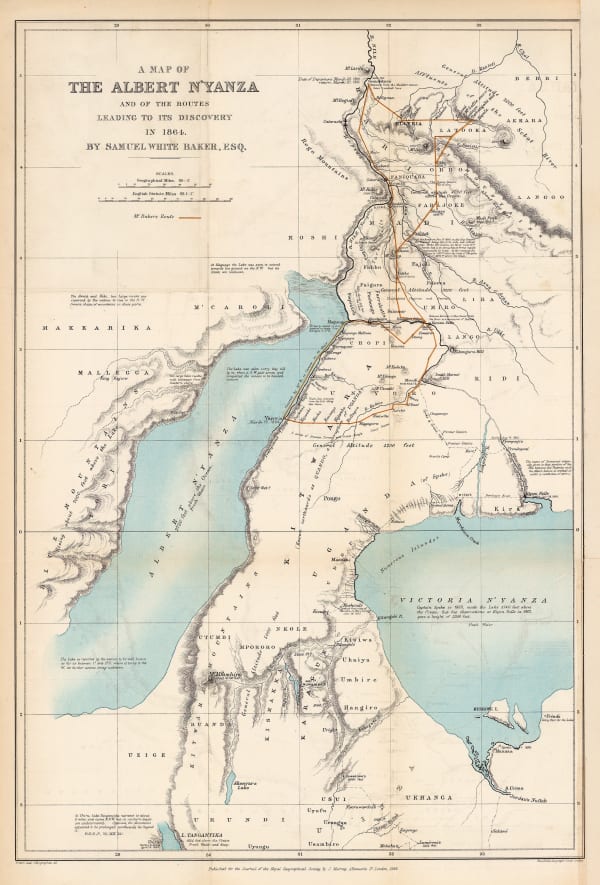
Royal Geographical Society (RGS), The Discovery of Lake Albert, 1866£ 645.00
-
Justus Perthes, Exploration of Zambia, Malawi & Tanzania, 1870£ 78.00
-
Royal Geographical Society (RGS), Slave Caravan Route, 1874£ 195.00
-
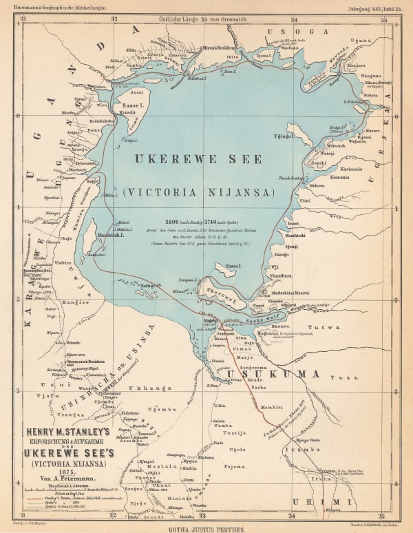
Justus Perthes, Lake Victoria according to Stanley, Speke & Grant, 1875£ 125.00
-
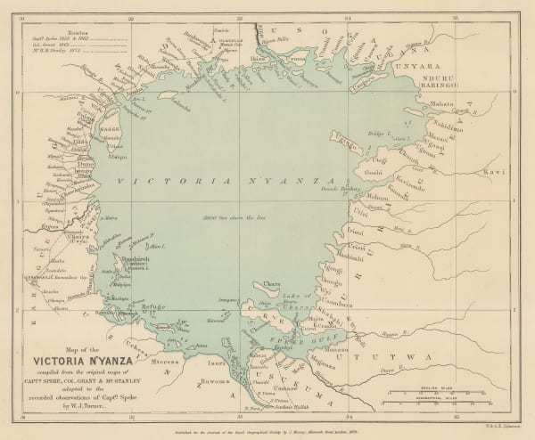
Lake Victoria according to Stanley, Speke & Grant, 1876Royal Geographical Society (RGS)Series: LondonRoyal Geographical Society (RGS), Lake Victoria according to Stanley, Speke & Grant, 1876£ 225.00
-
Lake Victoria according to Stanley, Speke & Grant, 1876Royal Geographical Society (RGS)Series: LondonRoyal Geographical Society (RGS), Lake Victoria according to Stanley, Speke & Grant, 1876£ 295.00
-
Sketch Map of Native Routes from Dar Es Salaam Towards the Head of Lake Nyassa, 1879Royal Geographical Society (RGS)Series: LondonRoyal Geographical Society (RGS), Sketch Map of Native Routes from Dar Es Salaam Towards the Head of Lake Nyassa, 1879£ 125.00
-
James Stewart's route between Lake Malawi and Lake Tanganyika, 1880Royal Geographical Society (RGS)Series: LondonRoyal Geographical Society (RGS), James Stewart's route between Lake Malawi and Lake Tanganyika, 1880£ 125.00
-
Map of the Route of the R.G.S. East African Expedition to Lakes Nyassa & Tanganyika, 1880Royal Geographical Society (RGS)Series: LondonRoyal Geographical Society (RGS), Map of the Route of the R.G.S. East African Expedition to Lakes Nyassa & Tanganyika, 1880£ 225.00
-
Justus Perthes, Equatorial East Africa, 1881£ 675.00
-
Royal Geographical Society (RGS), Mt Kilimanjaro, 1885£ 675.00
-
Scottish Geographical Society (SGS), Stanley's Emin Pasha Expedition, 1886£ 395.00
-
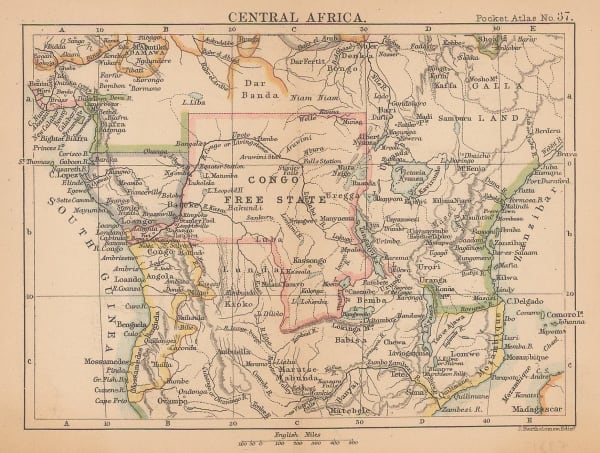
J.G. Bartholomew, Central Africa, 1887£ 42.00
-
Mr. C.S.Smiths Journeys near Mombasa and from Kilwa to the Rovuma, 1887Royal Geographical Society (RGS)Series: LondonRoyal Geographical Society (RGS), Mr. C.S.Smiths Journeys near Mombasa and from Kilwa to the Rovuma, 1887£ 88.00
-
The Stevenson Road from Lake Malawi to Lake Tanganyika, 1890Scottish Geographical Society (SGS)Series: LondonScottish Geographical Society (SGS), The Stevenson Road from Lake Malawi to Lake Tanganyika, 1890£ 275.00
-
Scottish Geographical Society (SGS), Stanley's Emin Pasha Expedition, 1890£ 775.00
-
Sketch Map of the Route of the Emin Pasha Relief Expedition, 1890Royal Geographical Society (RGS)Series: LondonRoyal Geographical Society (RGS), Sketch Map of the Route of the Emin Pasha Relief Expedition, 1890£ 325.00
-
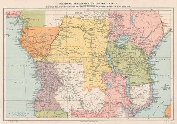
Scottish Geographical Society (SGS), Political Sketch-Map of Central Africa, 1890£ 595.00
-
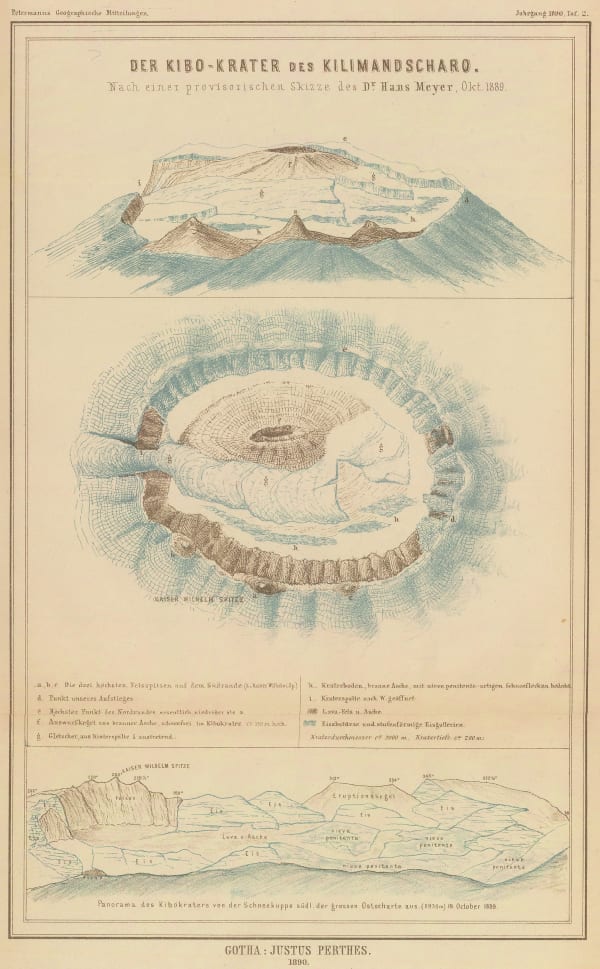
Justus Perthes, Mount Kilimanjaro, 1890£ 645.00
-
Imperial British East Africa (Kenya, Tanzania, Uganda), 1892Royal Geographical Society (RGS)Series: LondonRoyal Geographical Society (RGS), Imperial British East Africa (Kenya, Tanzania, Uganda), 1892£ 545.00
-
German missionary expeditions in north Malawi and southwest Tanzania, 1892Justus PerthesSeries: GothaJustus Perthes, German missionary expeditions in north Malawi and southwest Tanzania, 1892£ 68.00
-
Map of Part of British and German East Africa including the British Protectorate of Uganda, 1894War OfficeSeries: LondonWar Office, Map of Part of British and German East Africa including the British Protectorate of Uganda, 1894£ 1,650.00
-
Royal Geographical Society (RGS), Map of Part of East Africa, 1895£ 190.00
-
Justus Perthes, Kenya, Uganda and Tanzania, 1895£ 895.00
-
Justus Perthes, Mt Kenya to Mt Kilimanjaro, 1896£ 195.00
-
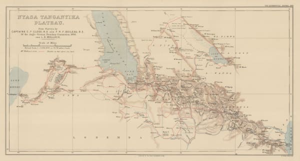
Royal Geographical Society (RGS), Survey map between Lakes Tanganyika and Malawi, 1899£ 295.00
-
Royal Geographical Society (RGS), Uganda and Kenya, 1903£ 425.00
-
Geographical Section, General Staff (GSGS), Kilimanjaro, 1905£ 895.00
-
Royal Geographical Society (RGS), Victoria Nyanza to Mt. Kilimanjaro, 1907£ 445.00
-
The Jubilee of Speke's Discovery of Victoria Nyanza, 1909Royal Geographical Society (RGS)Series: LondonRoyal Geographical Society (RGS), The Jubilee of Speke's Discovery of Victoria Nyanza, 1909£ 425.00
-
War Office, Lake Victoria, 1917£ 595.00
-
Royal Geographical Society (RGS), East Africa, 1918£ 525.00
-
J.G. Bartholomew, East Africa, 1922£ 145.00
-
James Truscott, Tanzania Agriculture, 1924£ 95.00
-
Geographical Section, General Staff (GSGS), Kenya Colony, 1927£ 875.00
-
George Philip & Son Ltd., Philips' New Wall Map of East Africa, 1930 c.£ 1,250.00
-
George Philip & Son Ltd., Map of Tanganyika Territory, 1933£ 875.00
-
Geographical Section, General Staff (GSGS), Tanganyika (Tanzania), 1943£ 445.00
-
Tanganyika Survey, Southeastern Tanzania, 1947£ 385.00
Tanzania
Our entire inventory of over 10,000 antique and vintage maps is now available to browse by region, date, cartographer, and subject