-
 Cornelis Wytfliet, Pacific Northwest, the Kingdom of Anian, 1607£ 3,250.00
 -
Russian Discoveries in Siberia, Alaska & the Bering Strait, 1750 c.Jacques-Nicolas BellinSeries: ParisJacques-Nicolas Bellin, Russian Discoveries in Siberia, Alaska & the Bering Strait, 1750 c.£ 725.00
-
Robert de Vaugondy, West coast of North America, 1772£ 695.00
-
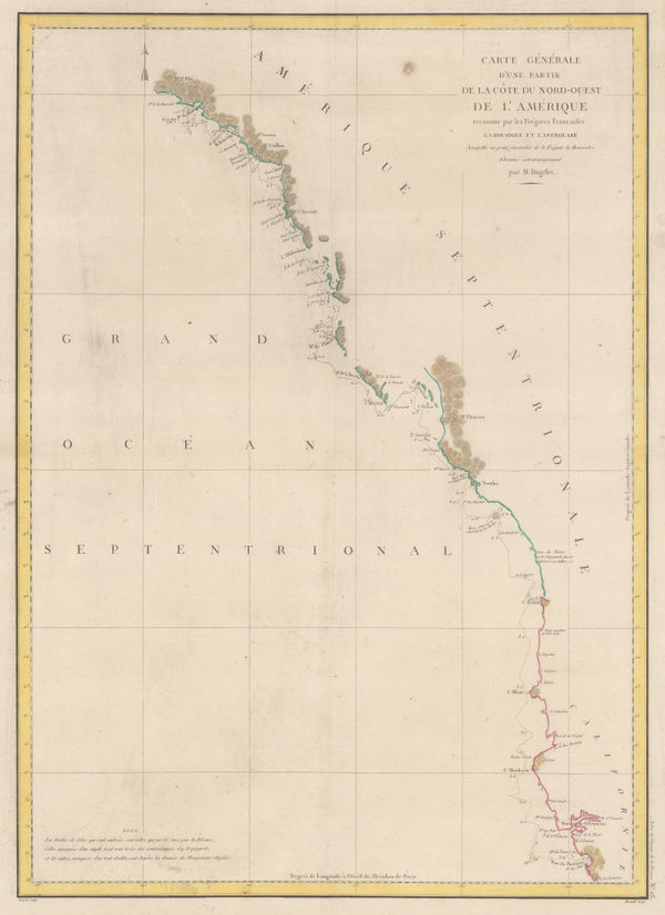
Jacques-Nicolas Bellin, North Pacific, Alaska & the Bering Strait, 1795 c£ 3,450.00
-
John Meares, Western Canada, 1795 c.£ 985.00
-
Comte de la Perouse's voyage, western coast of North America, 1797Jean Francois de La PerouseSeries: ParisJean Francois de La Perouse, Comte de la Perouse's voyage, western coast of North America, 1797£ 675.00
-
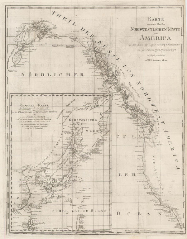
Daniel Friedrich Sotzmann, North West Pacific coast of America, 1800£ 795.00
-
Tardieu, Coast of British Columbia & Graham Island, 1810 c.£ 425.00
-
Philippe Vandermaelen, British Columbia north of Port Essington, 1827£ 95.00
-
Northern Alberta and Saskatchewan south of Lake Athabasca, 1827Philippe VandermaelenSeries: BrusselsPhilippe Vandermaelen, Northern Alberta and Saskatchewan south of Lake Athabasca, 1827£ 195.00
-
Philippe Vandermaelen, Hudson Bay coast, Manitoba, 1827£ 295.00
-
Philippe Vandermaelen, Lakes Winnipeg and Winnipegosis, Manitoba, 1827£ 350.00
-
Philippe Vandermaelen, Nunavut west of Chesterfield Inlet, 1827£ 90.00
-
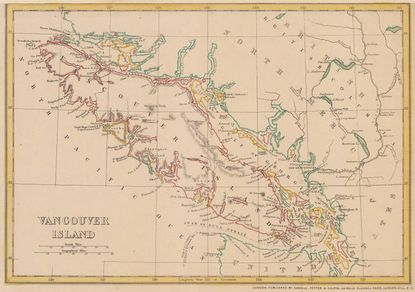
Early map of Vancouver Island and southern British Columbia, 1827Philippe VandermaelenSeries: BrusselsPhilippe Vandermaelen, Early map of Vancouver Island and southern British Columbia, 1827£ 1,650.00
-
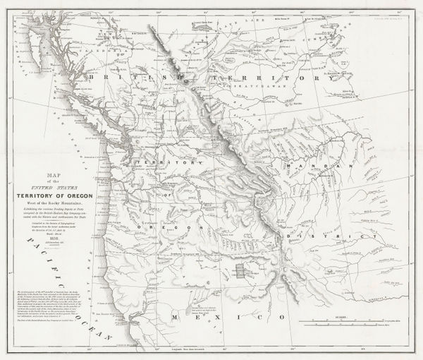
Washington Hood, Territory of Oregon West of the Rocky Mountains, 1838£ 2,450.00
-
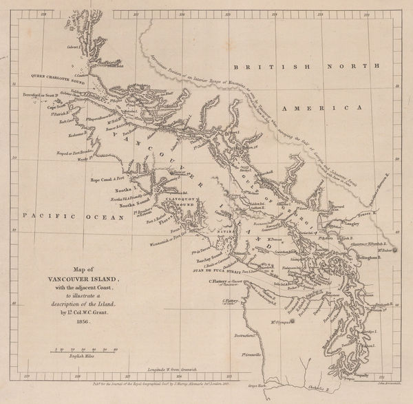
Royal Geographical Society (RGS), Southern coast of Vancouver Island, 1856£ 195.00
-
Royal Geographical Society (RGS), Vancouver Island and coast of British Columbia, 1857£ 485.00
-
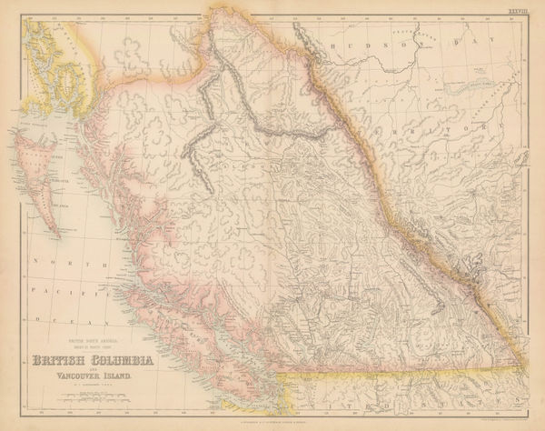
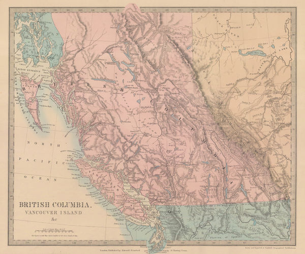
Archibald Fullarton, British Columbia & Vancouver Island, 1860 c.£ 545.00
-
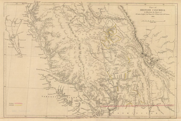
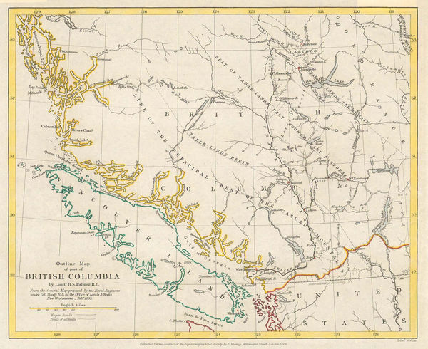
Royal Geographical Society (RGS), Southern British Columbia and Vancouver Island, 1861£ 445.00
-
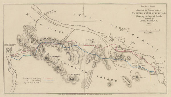
Southern Vancouver Island from Alberni Inlet to Nanaimo, 1862Royal Geographical Society (RGS)Series: LondonRoyal Geographical Society (RGS), Southern Vancouver Island from Alberni Inlet to Nanaimo, 1862£ 60.00
-
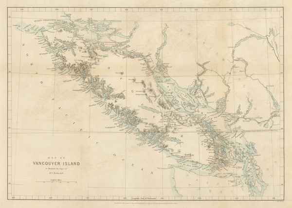
Royal Geographical Society (RGS), Vancouver Island, 1864£ 525.00
-
Royal Geographical Society (RGS), Vancouver Island & British Columbia, 1864£ 375.00
-
Justus Perthes, Vancouver Island, 1869£ 425.00
-
Society for the Diffusion of Useful Knowledge (SDUK), British Columbia & Vancouver Island, 1875£ 385.00
-
Western Canada showing Canada-United States border, 1876Royal Geographical Society (RGS)Series: LondonRoyal Geographical Society (RGS), Western Canada showing Canada-United States border, 1876£ 375.00
-
W. & A.K. Johnston, Vancouver Island, 1880 (c.)£ 95.00
-
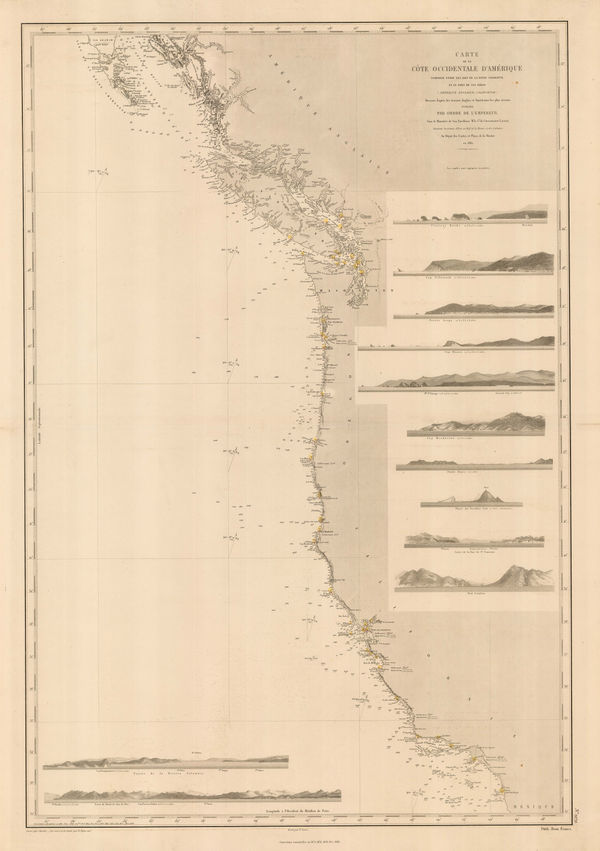
French Admiralty, Chart of the west coast of North America, 1881£ 825.00
-
Justus Perthes, Geological Map of Haida Gwaii, British Columbia, 1881£ 125.00
-
Royal Geographical Society (RGS), Athabasca District, Saskatchewan, 1883£ 395.00
-
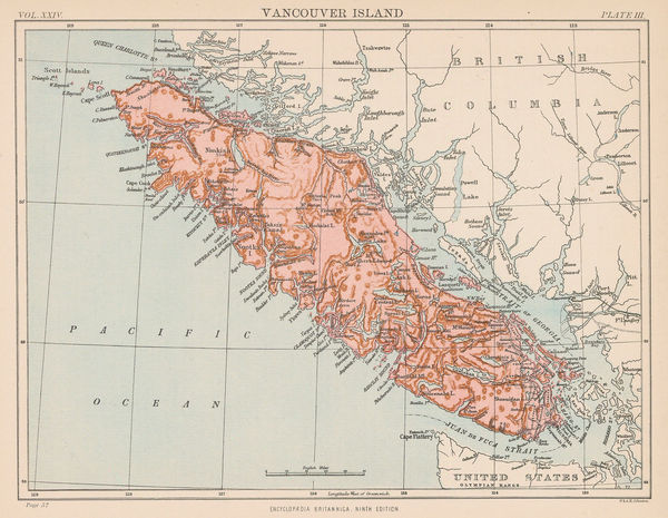
John Cassell, Vancouver Island, 1885 c.£ 195.00
-
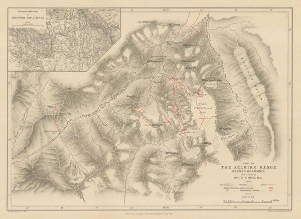
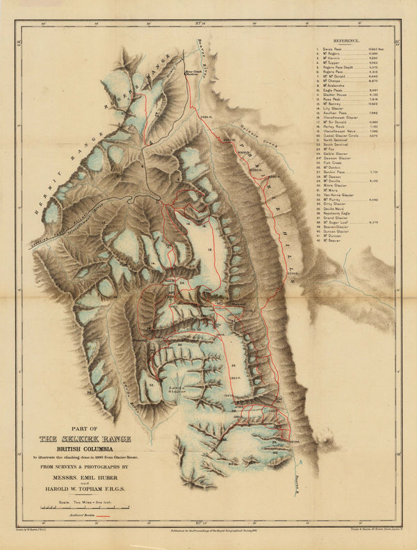
Royal Geographical Society (RGS), Selkirk Range, British Columbia, 1889£ 115.00
-
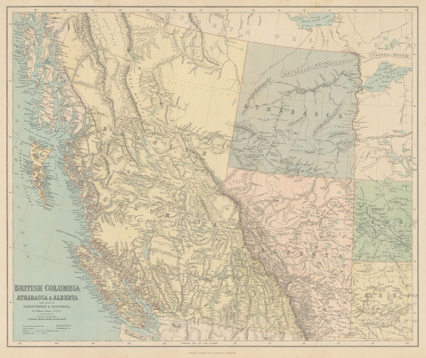
George Philip & Son Ltd., British Columbia, Athabasca & Alberta, 1890£ 245.00
-
Royal Geographical Society (RGS), Selkirk Range, British Columbia, 1891£ 145.00
-
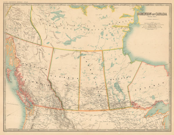
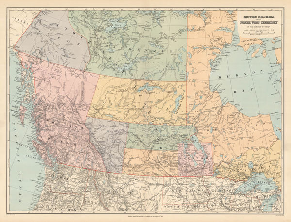
Edward Stanford, Western Canada, 1898£ 195.00
-
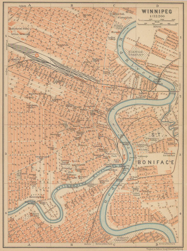
Karl Baedeker, Winnipeg, 1898£ 42.00
-
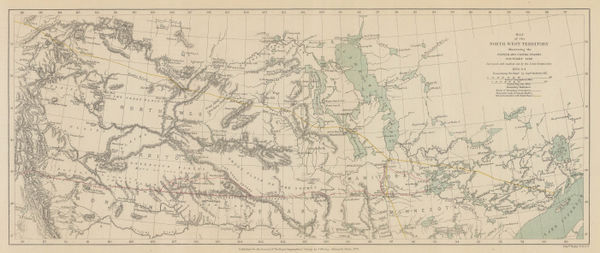
The North-Western Part of the Dominion of Canada, 1898Royal Geographical Society (RGS)Series: LondonRoyal Geographical Society (RGS), The North-Western Part of the Dominion of Canada, 1898£ 495.00
-
Royal Geographical Society (RGS), Waputik Mountains, Canadian Rockies, 1899£ 165.00
-
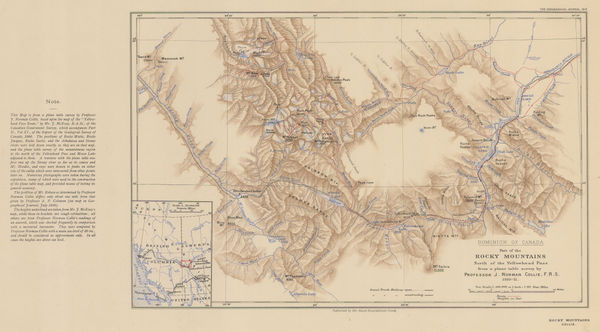
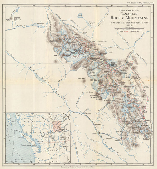
Part of the Canadian Rocky Mountains, British Columbia, 1903Royal Geographical Society (RGS)Series: LondonRoyal Geographical Society (RGS), Part of the Canadian Rocky Mountains, British Columbia, 1903£ 275.00
-
Karl Baedeker, [British Columbia and Vancouver Island], 1909£ 68.00
-
R.C. McPhillips, Map of the City of Winnipeg, 1910£ 895.00
-
George Griffith Aitken, British Columbia, 1912£ 3,250.00
-
Canadian Rocky Mountains North of the Yellowhead Pass, 1912Royal Geographical Society (RGS)Series: LondonRoyal Geographical Society (RGS), Canadian Rocky Mountains North of the Yellowhead Pass, 1912£ 235.00
-
W. & A.K. Johnston, Western Canada, 1912£ 125.00
-
T.N. Hibben & Co., Vancouver Island and southern British Columbia, 1912£ 885.00
-
Canadian Pacific Railway, Railway map of the Canadian Rocky Mountains, 1920 c£ 485.00
-
John Bartholomew & Son, British Columbia, 1922£ 95.00
-
John Bartholomew & Son, Alberta & Saskatchewan, 1922£ 95.00
-
John Bartholomew & Son, Manitoba & Northwest Ontario, 1922£ 95.00
-
John Bartholomew & Son, Western Canada, 1922£ 95.00
-
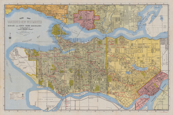
Grant & Sons, City of Vancouver, 1935£ 675.00
-
Anonymous, Vancouver, 1950 c.£ 125.00
-
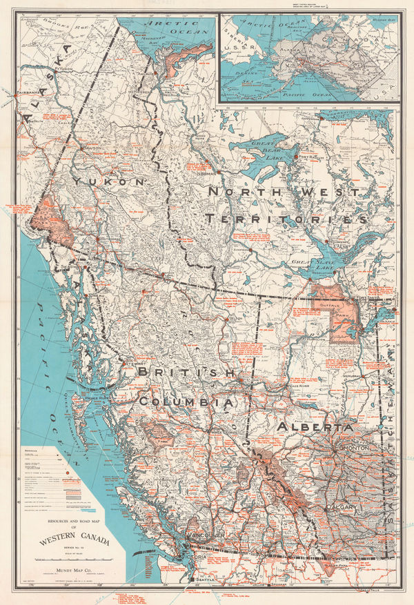
Mundy Map Co., Resources and Road Map of Western Canada, 1957£ 485.00
Western Canada
Our entire inventory of over 10,000 antique and vintage maps is now available to browse by region, date, cartographer, and subject


![Karl Baedeker, [British Columbia and Vancouver Island], 1909](https://static-assets.artlogic.net/w_600,c_limit,f_auto,fl_lossy,q_auto/artlogicstorage/themaphouse/images/view/99a3db3157adb371c8d7608b0b8487ccj/themaphouse-karl-baedeker-british-columbia-and-vancouver-island-1909.jpg)