-

-
-
-
British Admiralty, Japan. Naikai or Inland Sea. Izumi Nada and Harima Nada, 1923£ 495.00
-
British Admiralty, Japan. Shimonoseki Kaikyo, 1923£ 495.00
-
British Admiralty, Kiaochow Bay, 1923£ 985.00
-
-
British Admiralty, Ozuchi Jima to Funoka Sima, 1923£ 495.00
-
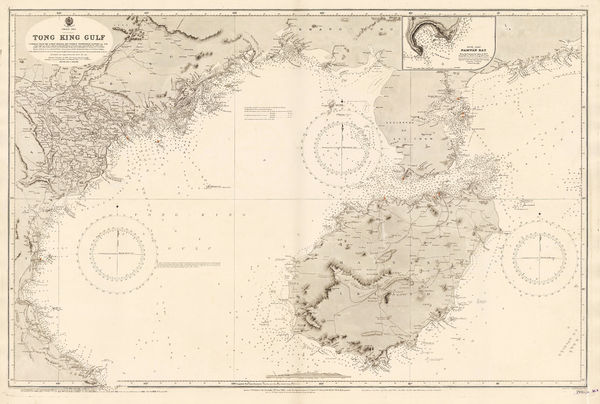
British Admiralty, The Brothers to Ockseu Is., 1923£ 1,950.00
-
-
Japanese Railways, Nanjing, 1923£ 125.00
-
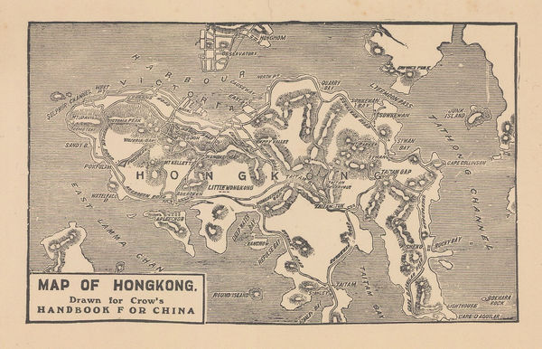
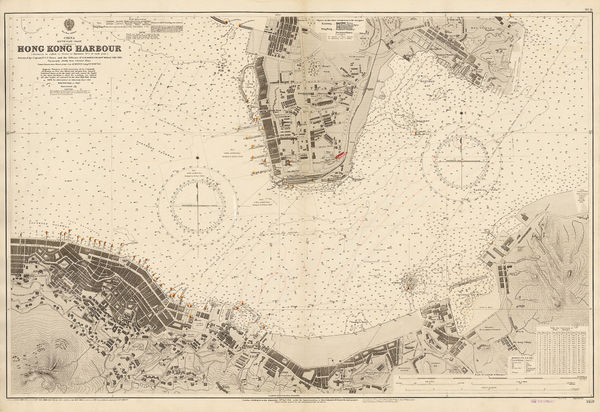
Carl Crow, Map of Hongkong, 1925£ 345.00
-
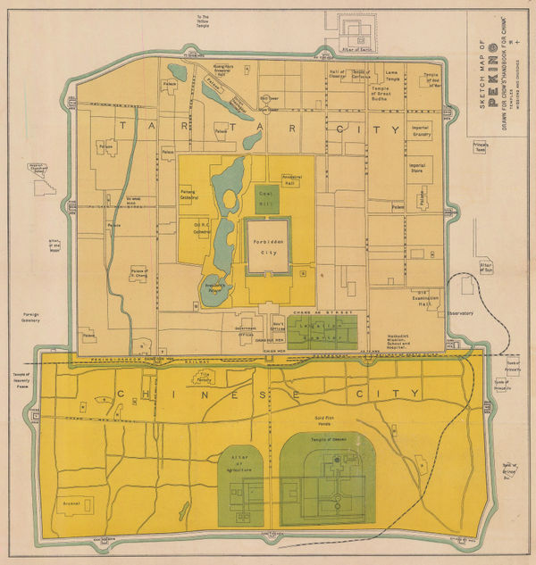
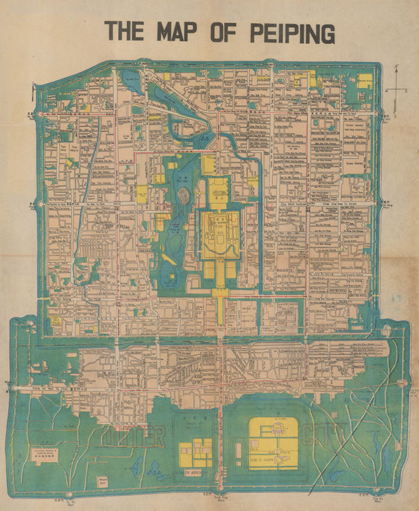
Carl Crow, Sketch Map of Beijing, 1925£ 325.00
-
Y Koshiba, Geological Map of Japanese Empire, 1926£ 1,550.00
-
Edward Stanford, A Map of China and Japan, 1929£ 975.00
-
British Admiralty, The Brothers to Ockseu Is., 1930£ 1,750.00
-
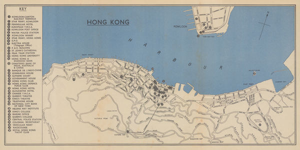
Edward Stanford, P&O Ports of Call - Hong Kong, 1930 (c.)£ 445.00
-
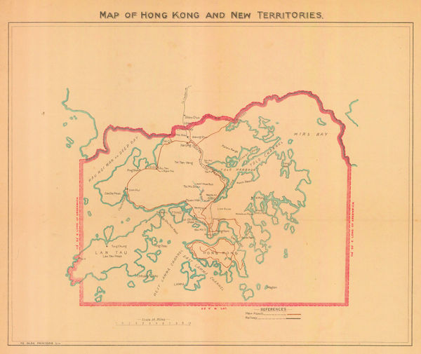
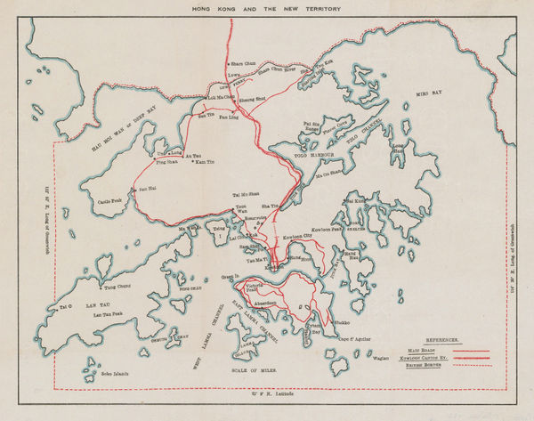
Ye Olde Printerie, Map of Hong Kong and New Territories, 1930 c£ 1,350.00
-
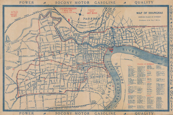
Navy Y. M. C. A., Map of Shanghai, 1930 c.£ 895.00
-
John Kirk Sewall, Pictorial map of Beijing, 1930 c.£ 3,500.00
-
-
Paplow & Barber, Hong Kong, 1931£ 875.00
-
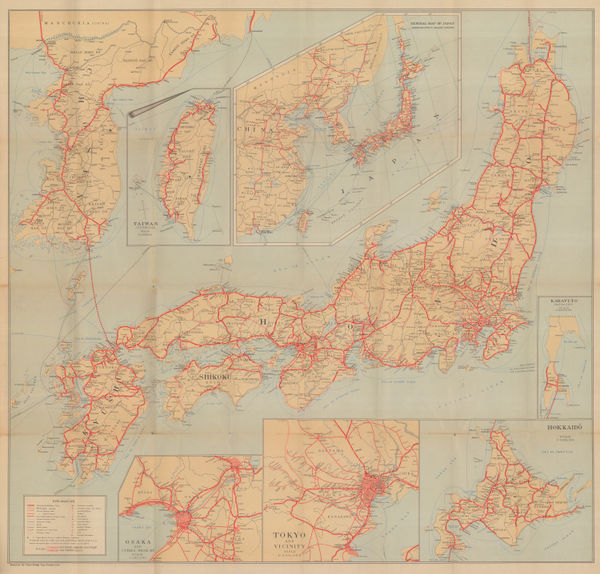
Japanese Railways, General Map of Japan, 1931£ 875.00
-
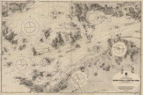
British Admiralty, Channels between Bingo Naga and Ozuchi Jima., 1932£ 495.00
-
-
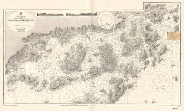
British Admiralty, Japan Inland Sea. Channels between Neko Seto & Mekari Seto, 1932£ 625.00
-
British Admiralty, Kiaochow Bay, 1932£ 1,850.00
-
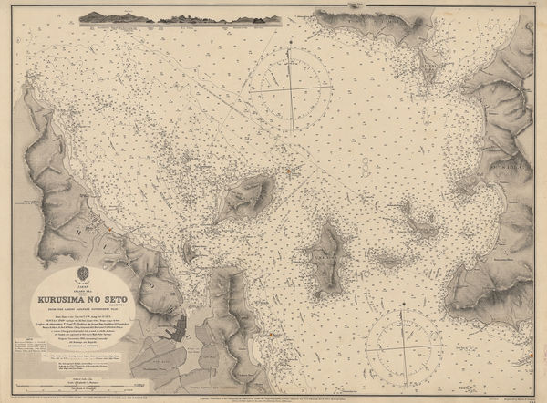
British Admiralty, Kurusima No Seto (Kaikyo), 1932£ 295.00
-
British Admiralty, Ockseu Is. to Tung Yung, 1932£ 885.00
-
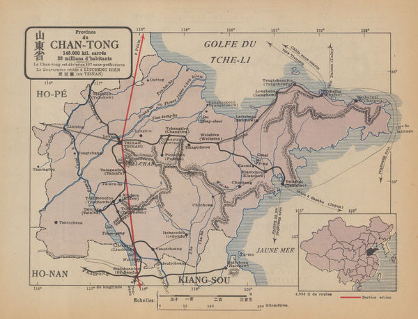
René Jouon, Province du Chiang-Tong, 1932£ 95.00
-
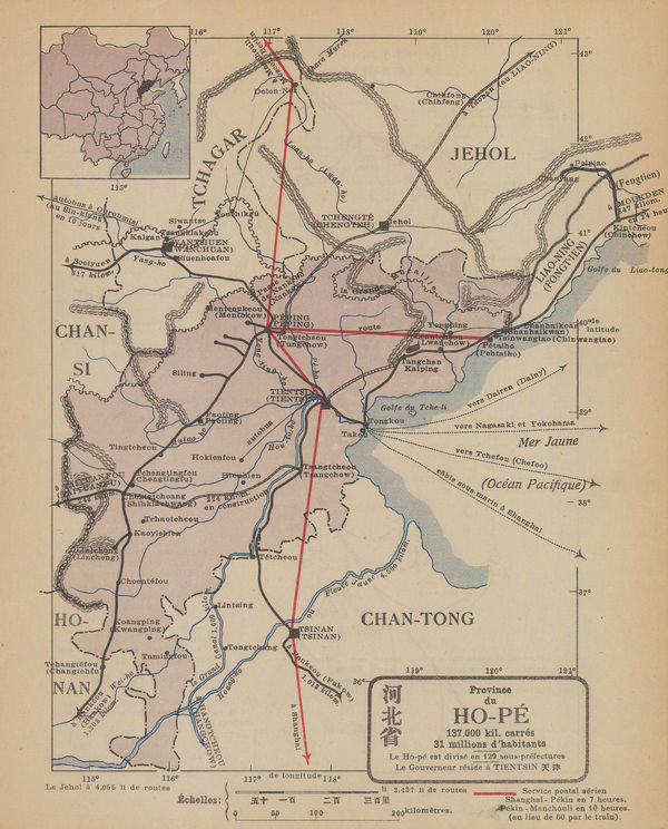
René Jouon, Provine du Ho-Pe, 1932£ 85.00
-
British Admiralty, Southern Approach to the Yangtze Kiang, 1932£ 1,450.00
-
British Admiralty, Tien Pak to Macao, 1932£ 1,550.00
-
British Admiralty, Tung Yung to Wen Chau Bay, 1932£ 885.00
-
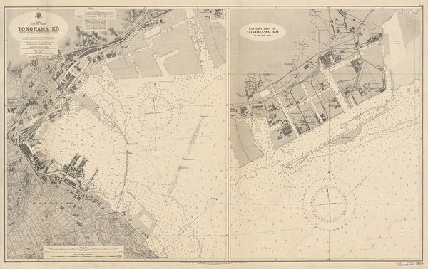
British Admiralty, YokoHama-Ko, 1932£ 725.00
-
C. Y. Soo, Map showing Japanese-Chinese Warfare now in Shanghai, 1932£ 1,250.00
-
Japanese Railways, Mount Fuji (Fuji-san), 1933£ 62.00
-
British Admiralty, Bingo Nada and Ozuchi Jima, 1934£ 495.00
-
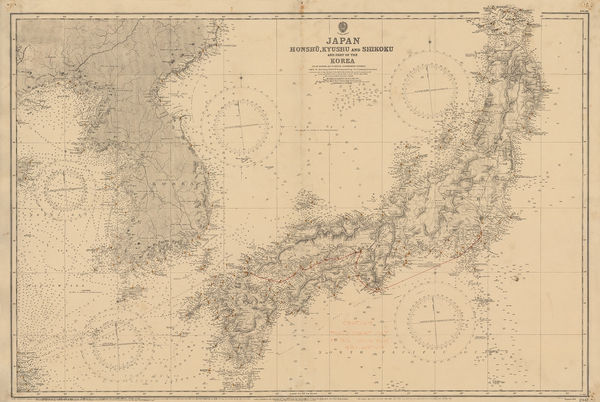
British Admiralty, Japan, Honshu, Kyushu & Shikoku and part of the Korea, 1934£ 895.00
-
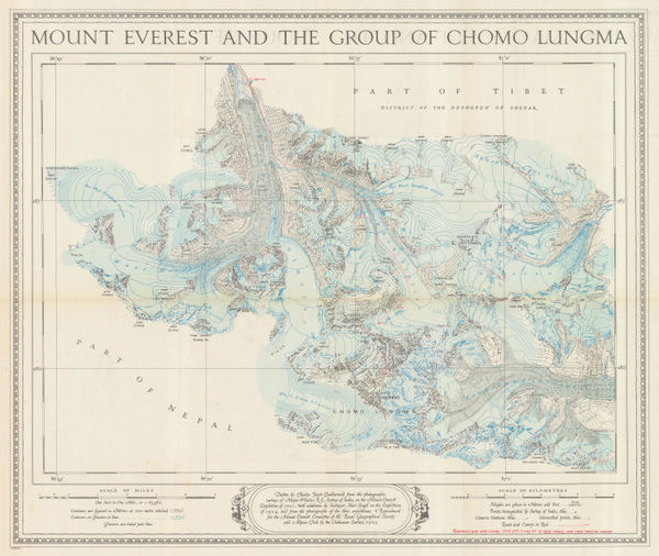
Ordnance Survey, Mount Everest and the Group of Chomo Lungma, 1934£ 1,500.00
-
Anonymous, Beijing, 1935 c£ 1,450.00
-
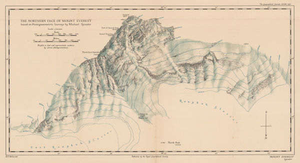
Royal Geographical Society (RGS), The Northern Face of Mount Everest, 1936£ 675.00
-
-
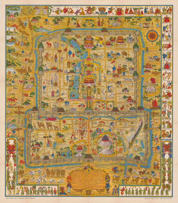
Frank Dorn, Beijing, 1936£ 2,850.00
-
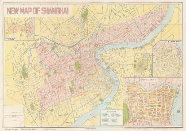
Fusazo Sugie, The New Map of Shanghai, 1936£ 3,500.00
-
Obuchi Yoshikichi, Taiwan, 1939£ 795.00
-
Lang Ke, New Map of Shanghai, 1940£ 1,850.00
-
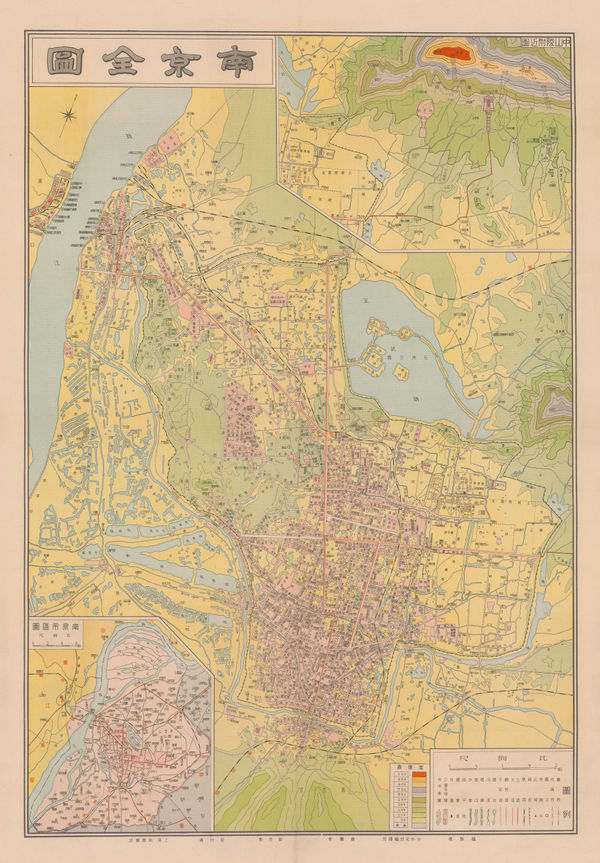
Anonymous, Nanjing City, 1940 c£ 750.00
-
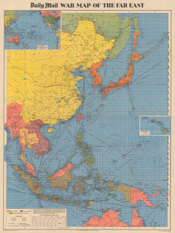
Edward Stanford, Map of the Far East, 1941£ 1,450.00
-
George Philip & Son Ltd., WW2 Map of the Far East, 1944£ 495.00
-
National War Front, WW2 Map of the Pacific Theatre, 1944 c.£ 485.00
-
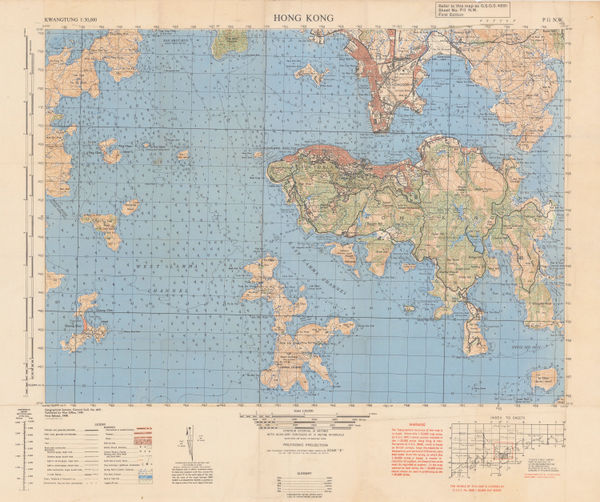
Geographical Section, General Staff (GSGS), Hong Kong, the New Territories and Southern China, 1949£ 950.00
-
War Office, Hong Kong, 1949£ 1,250.00
-
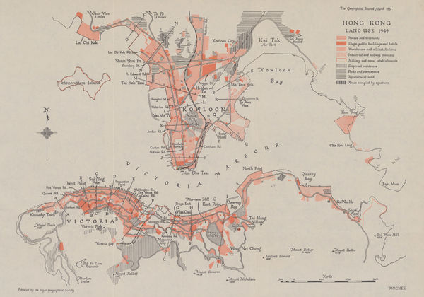
Royal Geographical Society (RGS), Hong Kong: Land Use 1949, 1951£ 785.00
-
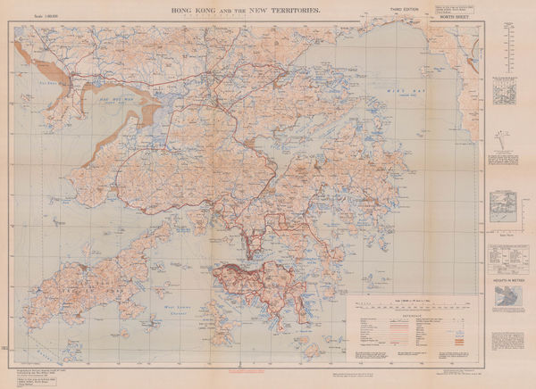
Geographical Section, General Staff (GSGS), Hong Kong and the New Territories, 1952£ 1,950.00
-
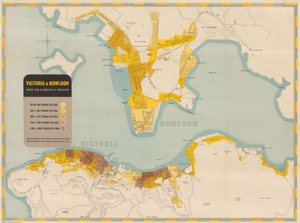
Hong Kong Public Works Dept., Victoria and Kowloon, 1952£ 950.00
-
Hong Kong Government, Hong Kong and part of the New Territories, 1953£ 145.00
-
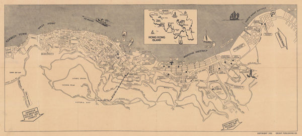
Orient Publishing Co, Victoria, Hong Kong, 1955£ 1,850.00
-
British Admiralty, Hsia-Men Chiang, 1957£ 425.00
-
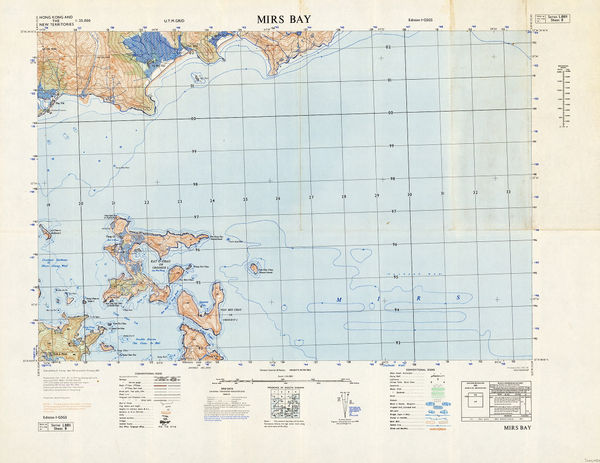
Geographical Section, General Staff (GSGS), Mirs Bay, 1957£ 245.00
-
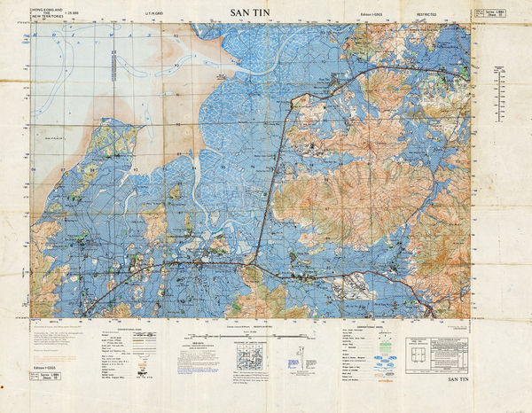
Geographical Section, General Staff (GSGS), San Tin, 1957£ 325.00
-
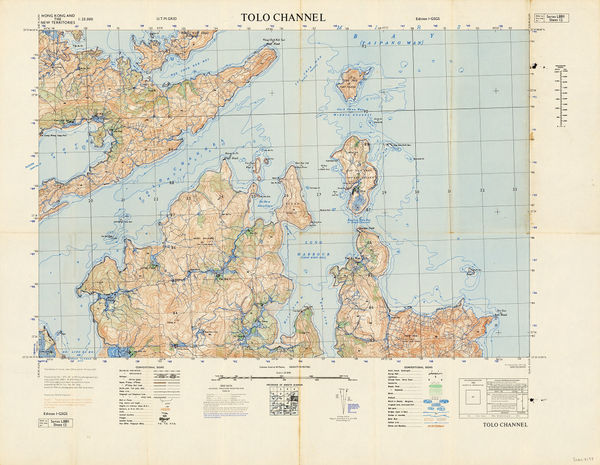
Geographical Section, General Staff (GSGS), Tolo Channel, 1957£ 345.00
-
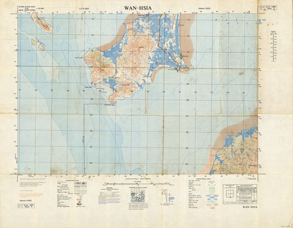
Geographical Section, General Staff (GSGS), Wan-Hsia, 1957£ 225.00
-
Service Ad. Company, Hong Kong - Wanchai and Central Districts, 1958£ 225.00
-
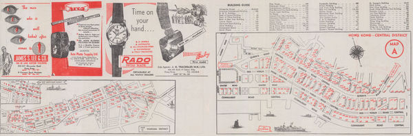
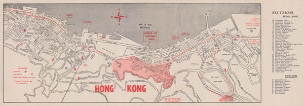
Servicemen's Guides, Hong Kong, 1958 (c.)£ 325.00
-
British Admiralty, Approaches to Hsia-Men, 1959£ 445.00
-
British Admiralty, Ch'ang Chiang, 1959£ 495.00
-
British Admiralty, China Sea, 1959£ 375.00
-
British Admiralty, Kiaochow Bay to Lai Chau Bay, 1959£ 375.00
-
British Admiralty, Kue Shan Id. to the Yangtze Kiang, 1959£ 385.00
-
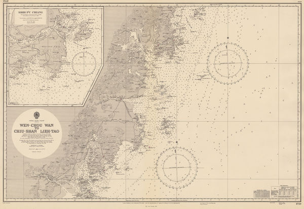
British Admiralty, Wen-Chou Wan to Chiu-Shan, Lieh- Tao, 1959£ 325.00
-
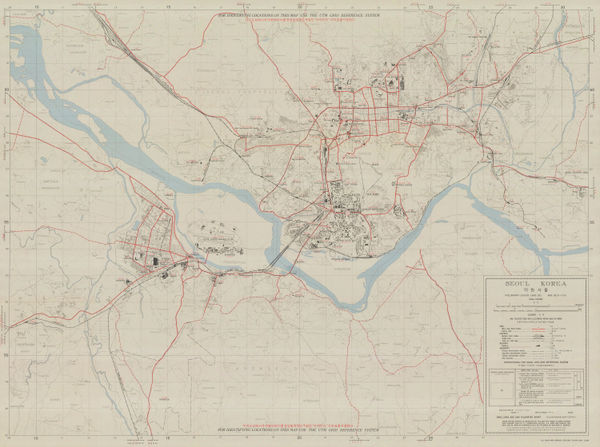
US Air Force, Seoul Road Map, 1959£ 3,950.00
-
British Admiralty, Cape Yatau to Tau Tsui Head, 1960£ 295.00
-
British Admiralty, China Sea - Northern Portion - Eastern Sheet, 1960£ 375.00
-
British Admiralty, Fan Rang Bay to Ton King Gulf, 1960£ 325.00
-
British Admiralty, Hong Kong to the Three Brothers, 1960£ 475.00
-
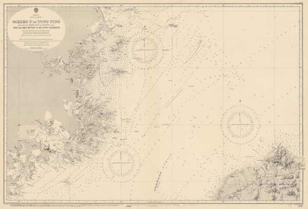
British Admiralty, Ockseu Id. to Tung Yung, 1960£ 375.00
-
British Admiralty, The Brothers to Ockseu Id., 1960£ 425.00
-
British Admiralty, Tung-Yin Shan to Wen-Chou Wan, 1960£ 325.00
-
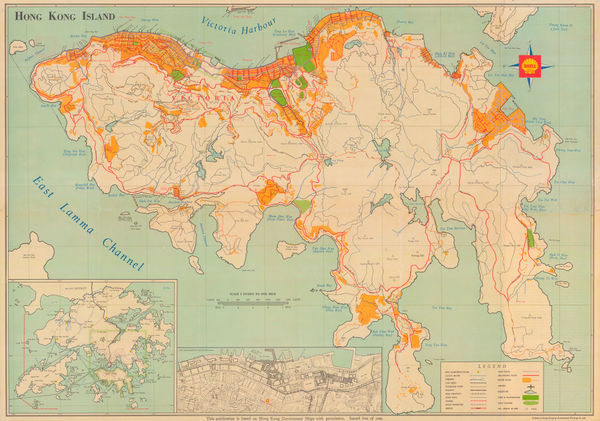
Continental Printing Co., Hong Kong Island, 1960 (c.)£ 1,250.00


Page
4
of 5