-
 Thomas Jefferys, Plan of La Hogue with the Intended Works, 1800 c.£ 75.00
 -
William Heather, Bay of Biscay, 1802£ 1,950.00
-
William Heather, Boulogne coast and environs, 1803£ 645.00
-
-
-
Joseph Roux, Bay of Marseille, 1804£ 85.00
-
Joseph Roux, [Toulon], 1804£ 85.00
-
John Wilkes, France during the Napoleonic period, 1805£ 65.00
-
Robert Wilkinson, France Divided into Provinces, 1805£ 65.00
-
John Cary, France prior to the French Revolution, 1806£ 245.00
-
William Guthrie, France divided into departments, 1807£ 58.00
-
John Pinkerton, France, 1809£ 195.00
-
William Faden, The French Empire and the Kingdom of Italy, 1813£ 1,450.00
-
John Thomson, France, 1814£ 175.00
-
C.V. Lavoisne, Geographical and Historical Map of France, 1816£ 175.00
-
William Faden, The Kingdom of France, 1816£ 475.00
-
John Thomson, France, 1817 c.£ 115.00
-
William Faden, France Divided into Military Governments as in 1790, 1819£ 45.00
-
George Ellis, France divided into departments, 1819 c.£ 48.00
-
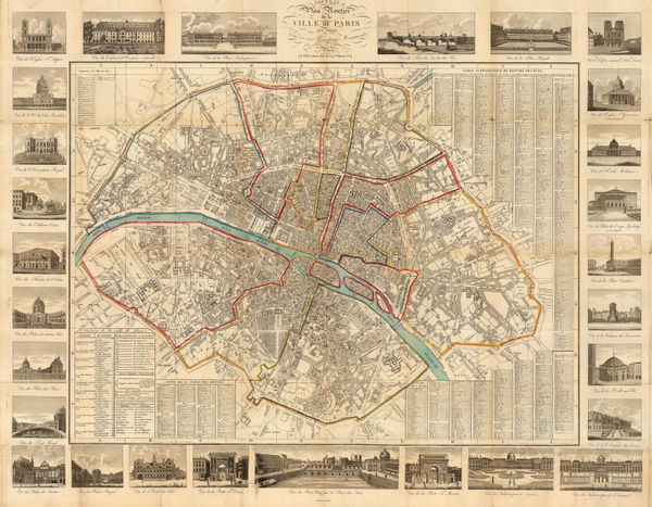
Pierre Jean, Plan of Paris, 1821£ 595.00
-
Henry Fisher, France, 1823£ 48.00
-
Seguin, Paris, 1825£ 895.00
-
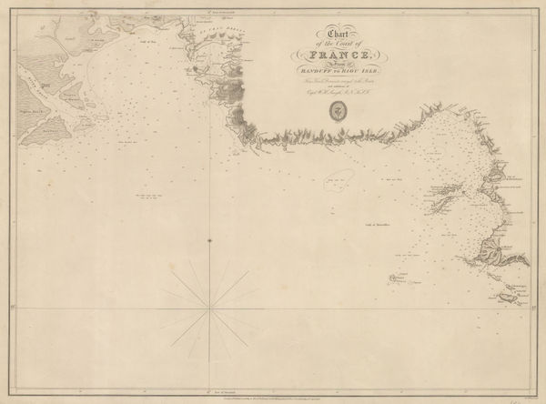
British Admiralty, Chart of the Coast of France, 1826£ 160.00
-
Andree Martin, Paris, prior to Hausmann's renovation, 1827£ 625.00
-
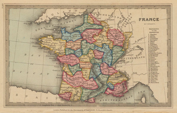
Thomas Starling, France, 1830 c.£ 52.00
-
Perrier et Gallet, Central Paris, 1831£ 345.00
-
W. & A.K. Johnston, France, 1840 c.£ 85.00
-
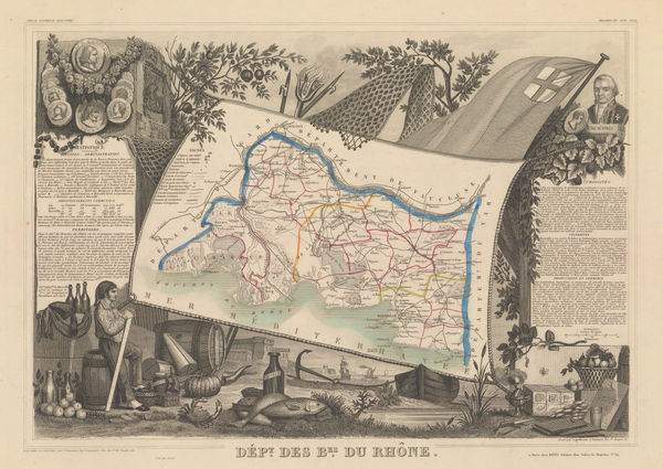
Victor Levasseur, Bouches-du-Rhône, 1840 c.£ 60.00
-
British Admiralty, France South Coast: Port Vendre, 1843£ 50.00
-
Alexandre Vuillemin, Pictorial plan of Paris, 1843£ 650.00
-
Society for the Diffusion of Useful Knowledge (SDUK), Marseille, 1844£ 98.00
-
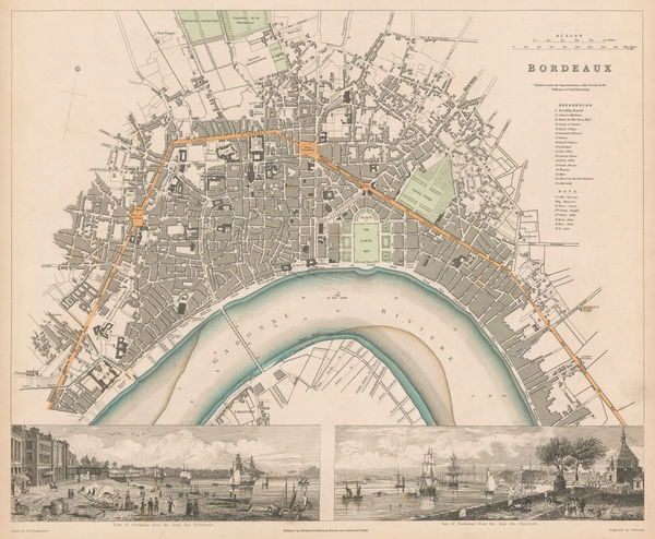
Society for the Diffusion of Useful Knowledge (SDUK), Bordeaux, 1844£ 195.00
-
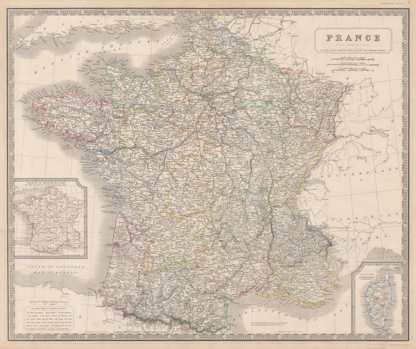
James Wyld, The Kingdom of France, 1844 c.£ 295.00
-
Victor Levasseur, Morbihan - Brittany, 1845£ 60.00
-
Victor Levasseur, Charente, 1845£ 75.00
-
Victor Levasseur, Corrèze, 1845£ 60.00
-
Victor Levasseur, Creuse, 1845£ 60.00
-
Victor Levasseur, Manche, 1845£ 80.00
-
Victor Levasseur, Finistère, 1845£ 80.00
-
Victor Levasseur, Haut-Rhin, 1845£ 80.00
-
Victor Levasseur, Rhône, 1845£ 80.00
-
Victor Levasseur, Vendée, 1845£ 75.00
-
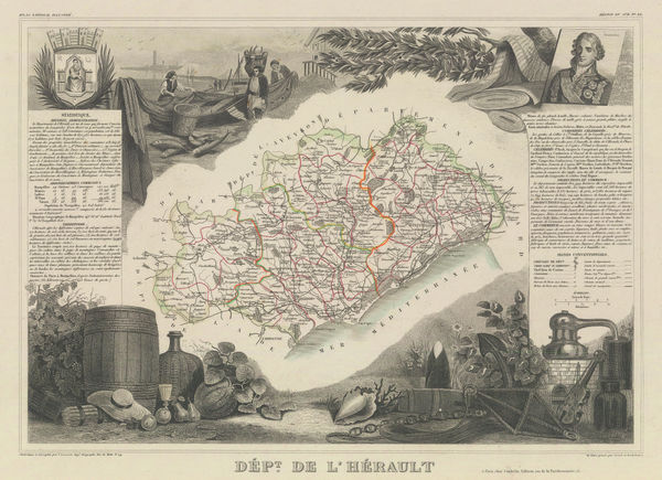
Victor Levasseur, Hérault, 1845£ 85.00
-
Victor Levasseur, Dordogne, 1845£ 120.00
-
Victor Levasseur, Indre-et-Loire, 1847£ 75.00
-
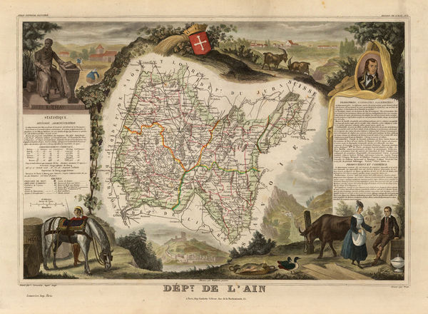
Victor Levasseur, Ain, 1847£ 70.00
-
Victor Levasseur, Aisne, 1847£ 70.00
-
Victor Levasseur, Ardèche, 1847£ 58.00
-
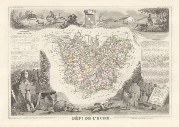
Victor Levasseur, Eure, 1847£ 75.00
-
Victor Levasseur, Isère, 1847£ 175.00
-
Victor Levasseur, Côte-d'Or, 1847£ 60.00
-
Victor Levasseur, Haute-Garonne, 1847£ 60.00
-
Victor Levasseur, Haute-Marne, 1847£ 60.00
-
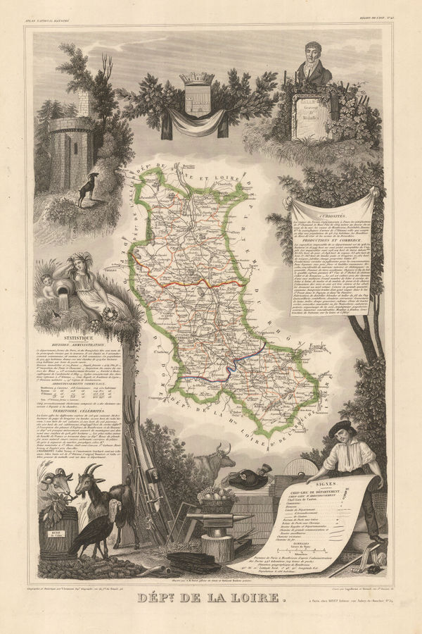
Victor Levasseur, Loire, 1847£ 60.00
-
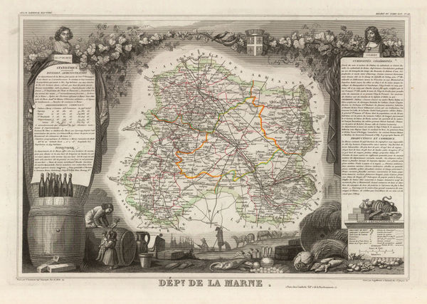
Victor Levasseur, Marne, 1847£ 75.00
-
Victor Levasseur, Saône-et-Loire, 1847£ 60.00
-
Victor Levasseur, Hautes-Alpes, 1847£ 68.00
-
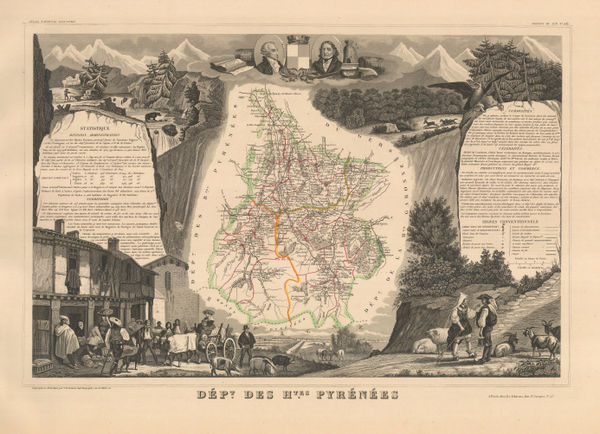
Victor Levasseur, Hautes-Pyrénées, 1847£ 95.00
-
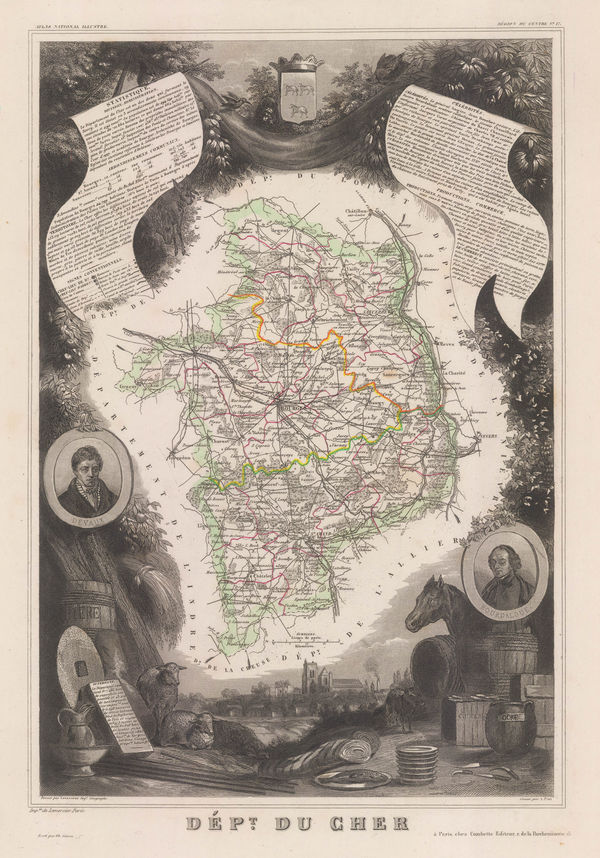
Victor Levasseur, Cher, 1847£ 60.00
-
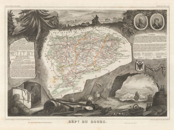
Victor Levasseur, Doubs, 1847£ 65.00
-
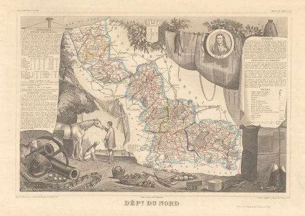
Victor Levasseur, Nord, 1847£ 60.00
-
Victor Levasseur, Pas-de-Calais, 1847£ 60.00
-
Victor Levasseur, Var, 1847£ 250.00
-
Henry Teesdale, France, 1847£ 75.00
-
Victor Levasseur, Vienne, 1847£ 60.00
-
Victor Levasseur, Haute-Vienne, 1847£ 60.00
-
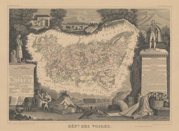
Victor Levasseur, Vosges, 1847£ 60.00
-
Victor Levasseur, Yonne, 1847£ 60.00
-
Victor Levasseur, Paris & Environs (Seine-et-Oise), 1847£ 75.00
-
Victor Levasseur, Deux-Sèvres, 1847£ 60.00
-
Victor Levasseur, Seine-Maritime (Seine-Inférieure), 1847£ 75.00
-
Victor Levasseur, Seine-et-Marne, 1847£ 60.00
-
Victor Levasseur, Haute-Saône, 1847£ 30.00
-
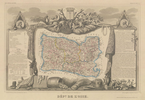
Victor Levasseur, Oise, 1847£ 60.00
-
Victor Levasseur, Orne, 1847£ 60.00
-
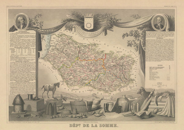
Victor Levasseur, Somme, 1847£ 80.00
-
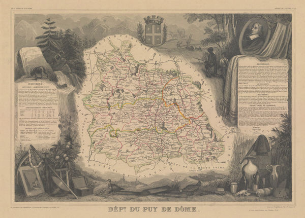
Victor Levasseur, Puy-de-Dôme, 1847£ 60.00
-
Victor Levasseur, Nièvre, 1847£ 60.00
-
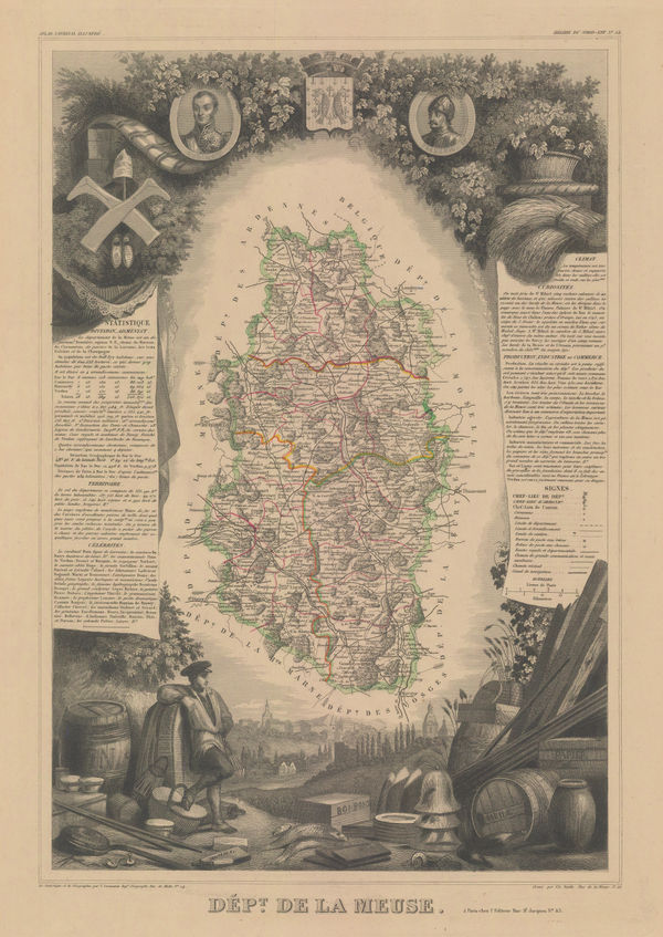
Victor Levasseur, Meuse, 1847£ 60.00
-
Victor Levasseur, Meurthe-et-Moselle, 1847£ 60.00


![Joseph Roux, [Toulon], 1804](https://static-assets.artlogic.net/w_600,c_limit,f_auto,fl_lossy,q_auto/artlogicstorage/themaphouse/images/view/82a0f77582740298dc8cc8514aa7032dj/themaphouse-joseph-roux-toulon-1804.jpg)


Page
4
of 7