-

-
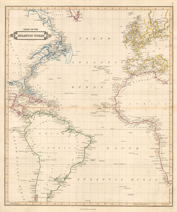
William Heather, Chart of the Atlantic Ocean, 1807£ 4,500.00
-
Robert Wilkinson, Kingdom of Jerusalem, 1807£ 125.00
-
Robert Wilkinson, The Empire of Alexander the Great, 1807£ 145.00
-
Spanish Admiralty, St. Augustine, 1809£ 975.00
-
Rare Spanish Admiralty chart of the mouth of the St. Johns River, 1809Spanish AdmiraltySeries: MadridSpanish Admiralty, Rare Spanish Admiralty chart of the mouth of the St. Johns River, 1809£ 450.00
-
British Admiralty, Plan of the City Port and Arsenal of Cathagena, 1810£ 380.00
-
Capt. James Horsburgh, Sea Chart of South Africa & Madagascar, 1812£ 785.00
-
C.V. Lavoisne, Geographical and Historical Map of Greece, 1813£ 245.00
-
-
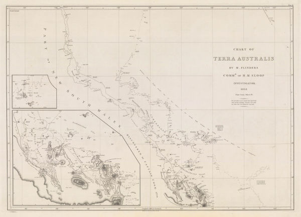
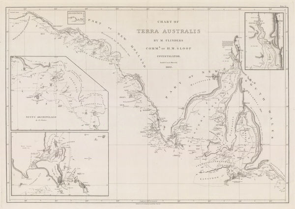
Matthew Flinders, Sea Chart from Brisbane to Port Macquarie, 1814£ 3,500.00
-
The Coast of Queensland from the Sunshine Coast to Shoalwater Bay, 1814Matthew FlindersSeries: LondonMatthew Flinders, The Coast of Queensland from the Sunshine Coast to Shoalwater Bay, 1814£ 4,500.00
-
Matthew Flinders, The Coast of Queensland from Shoalwater Bay to Cairns, 1814£ 4,500.00
-
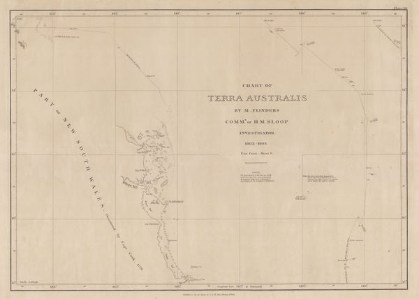
Matthew Flinders, The Coast of Queensland from Cairns to Cape Flattery, 1814£ 3,000.00
-
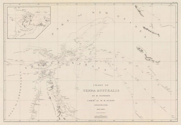
Matthew Flinders, Sea Chart of the Torres Strait, 1814£ 3,500.00
-
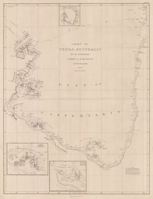
Matthew Flinders, The Gulf of Carpentaria, 1814£ 4,000.00
-
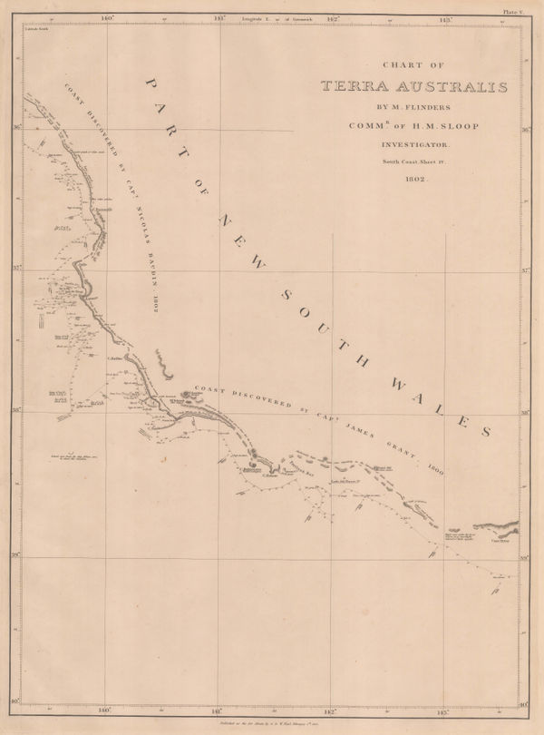
Matthew Flinders, South coast of Western Australia from Cape Leeuwin to Cape Arid, 1814£ 3,500.00
-
-
-
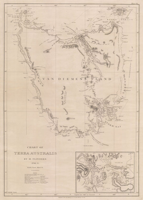
Matthew Flinders, Chart of Tasmania, 1814£ 4,500.00
-
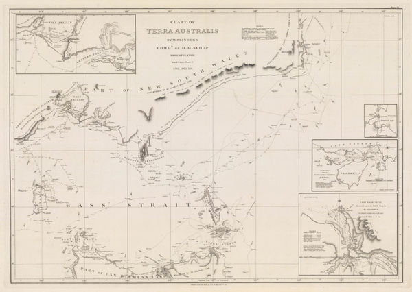
Matthew Flinders, Southern Australian coast from Melbourne to Adelaide, 1814£ 2,500.00
-
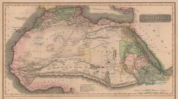
John Thomson, North Africa, 1814£ 315.00
-
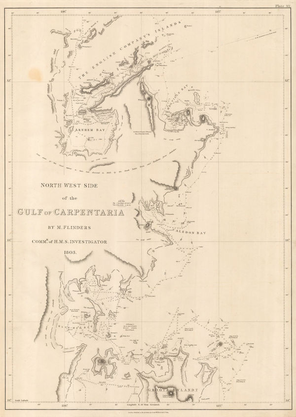
Matthew Flinders, Gulf of Carpentaria, northwest shore, 1814£ 2,000.00
-
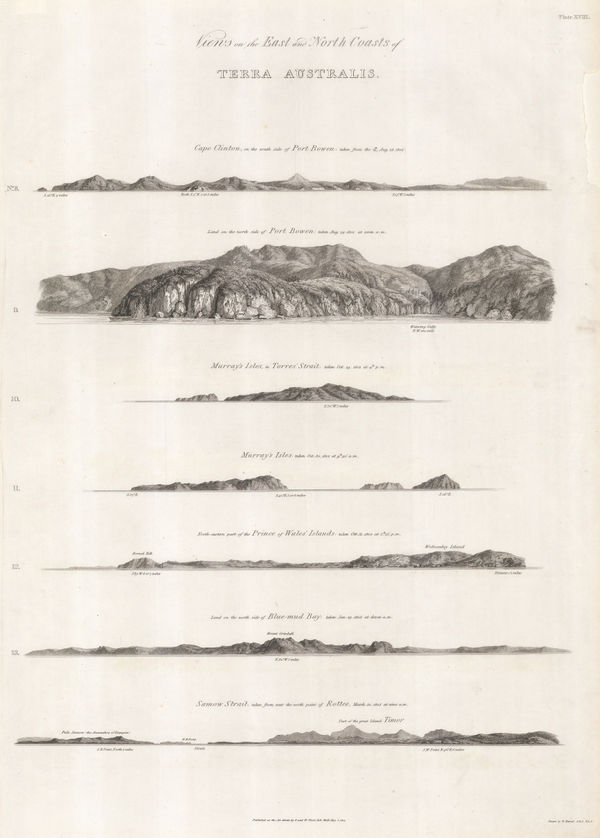
Matthew Flinders, Views of Queensland and the Torres Strait coast, 1814£ 750.00
-
Thomas Kitchin, The Roman Empire (East & West), 1815£ 550.00
-
British Admiralty, A Survey of the Island of Trinidad, 1816£ 1,450.00
-
John Thomson, Chart of the North and Baltic Seas, 1816£ 485.00
-
Thomas Kelly, Plan of the Battle of Waterloo, 1816£ 850.00
-
J. Freeman & Samuel Dana, A Geological Map of Boston and its Vicinity, 1818£ 1,450.00
-
Map of Maj. Gen. Ross's route, with the British Column, from Benedict, on the Patuxent River, to the City of Washington, August 1814, 1818William JamesSeries: Washington, D.C.William James, Map of Maj. Gen. Ross's route, with the British Column, from Benedict, on the Patuxent River, to the City of Washington, August 1814, 1818£ 885.00
-
John William Norie, Chart of the White Sea, 1819£ 2,250.00
-
Richard Holmes Laurie, Ancient Greece, 1820£ 625.00
-
French Admiralty, Chart of the Black Sea, 1822£ 625.00
-
A Geological Sketch of Malwa, and part of the Adjoining Provinces, 1823Capt. F. DangerfieldSeries: LondonCapt. F. Dangerfield, A Geological Sketch of Malwa, and part of the Adjoining Provinces, 1823£ 95.00
-
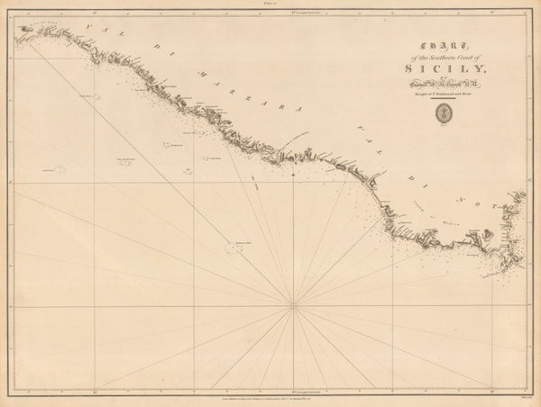
British Admiralty, Chart of the Southern Coast of Sicily, 1823£ 175.00
-
French Admiralty, Chart of the town and harbour of Tripoli, Libya, 1823£ 285.00
-
British Admiralty, Plan of the City, Environs and Anchorage of Girgenti, 1823£ 275.00
-
John William Norie, A New Chart of the Coasts of England and Holland, 1824£ 2,250.00
-
Chart of Part of the North Eastern Coast of America, and its adjacent Islands, 1824Sir William Edward ParrySeries: LondonSir William Edward Parry, Chart of Part of the North Eastern Coast of America, and its adjacent Islands, 1824£ 545.00
-
British Admiralty, Plan of the City, Harbours, & Environs of Alexandria, 1825£ 500.00
-
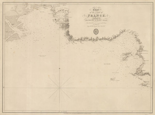
British Admiralty, Chart of the Coast of France, 1826£ 160.00
-
British Admiralty, The Coast of Italy from Naples to Cape Vaticano, 1827£ 200.00
-
J. Vincent, Ancient Scythia , 1828£ 64.00
-
British Admiralty, Sea Chart of the coast of Mozambique, 1828£ 145.00
-
British Admiralty, Sea Chart of the coast of Mozambique, 1828£ 225.00
-
J. Vincent, Pass of Thermopylae, 1828£ 125.00
-
J. Vincent, The Battle of Cannae, 1828£ 125.00
-
J. Vincent, Ancient Greece and its Colonies, 1828£ 125.00
-
J. Vincent, Corfu, 1828£ 75.00
-
J. Vincent, Plan of Syracuse, 1828£ 75.00
-
J. Vincent, Gulf of Corinth, 1828£ 95.00
-
J. Vincent, Coast and Islands of the Aegean Sea, 1828£ 75.00
-
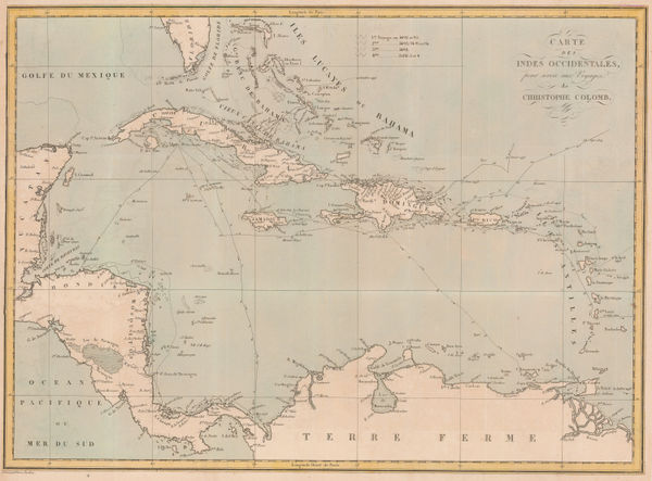
Pierre Tardieu, The Voyages of Christopher Columbus, 1828£ 950.00
-
Adrien Brue, Ancient Greece, 1829£ 225.00
-
Edward Quin, A.D. 1100. Period of the First Crusade, 1830 c.£ 245.00
-
Edward Quin, A.D. 1294. The Empire of Kublai Khan, 1830 c.£ 545.00
-
Edward Quin, A.D. 1551. At the Death of Charles V., 1830 c.£ 495.00
-
Edward Quin, A.D. 1660. At the Restoration of the Stuarts, 1830 c.£ 495.00
-
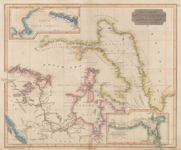
John Thomson, Discoveries of Ross, Parry & Franklin in the Arctic , 1830 c.£ 2,950.00
-
Chart of the North Coast of Africa from Ras al Halal to Alexandria, 1833British AdmiraltySeries: LondonBritish Admiralty, Chart of the North Coast of Africa from Ras al Halal to Alexandria, 1833£ 180.00
-
British Admiralty, Plan of the Harbour of Tripoli, 1835£ 300.00
-
British Admiralty, The Harbour and Bays of Trincomalee, 1835 c.£ 490.00
-
William Buckland, Ideal Cross-Section of the Earth, 1836£ 2,500.00
-
Edward Quin, A.D. 395. The Division of the Roman Empire, 1836£ 225.00
-
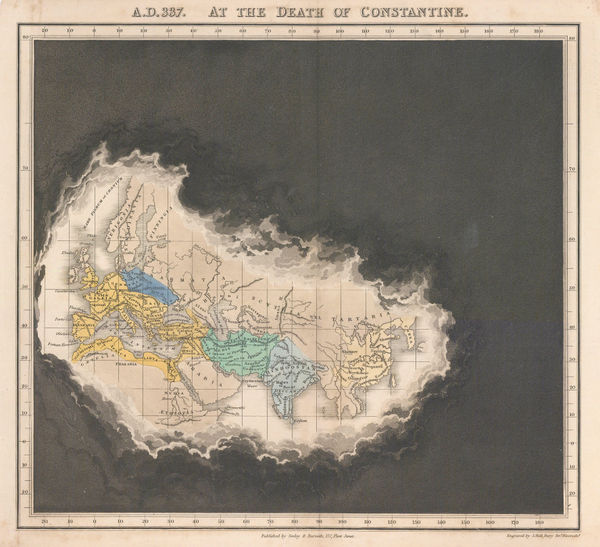
Edward Quin, A.D. 337 At the Death of Constantine, 1836£ 295.00
-
Edward Quin, B.C. 753 The Foundation of Rome , 1836£ 115.00
-
Edward Quin, B.C. 301. Exhibiting the Partition of the Empire of Alexander, 1836£ 95.00
-
J. & C. Walker, A Geological Map of England, Wales, and Part of Scotland, 1837£ 4,500.00
-
Royal Geographical Society (RGS), Ancient settlements of Minoa and Nisea, 1837£ 58.00
-
Spanish Admiralty, Chart of Florida, Bahamas and Cuba , 1838£ 4,850.00
-
Royal Geographical Society (RGS), Sketch map of the Iran and Iraq border, 1839£ 145.00
-
Comparative View of the Mountains, Rivers & Waterfalls of the World, 1839 c.Charles V. MoninSeries: Paris & LyonCharles V. Monin, Comparative View of the Mountains, Rivers & Waterfalls of the World, 1839 c.£ 1,750.00
-
James Wyld, Map of America, 1840£ 875.00
-
Daniel & William Lizars, Chart of the Atlantic Ocean, 1840 c.£ 145.00
-
Compartative View of the Principal Mountains and Rivers in the World, 1840 c.Sidney HallSeries: LondonSidney Hall, Compartative View of the Principal Mountains and Rivers in the World, 1840 c.£ 475.00
-
Charles V. Monin, Tableau Comparatif de la Hauteur des Montagnes, 1840 c.£ 475.00
-
-
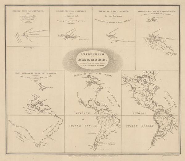
Daniel Veelward, The Discovery of America, 1842£ 350.00
-
Sketch of the Acquisitions of Russia since the Accession of Peter 1st to the Throne, 1842John ArrowsmithSeries: LondonJohn Arrowsmith, Sketch of the Acquisitions of Russia since the Accession of Peter 1st to the Throne, 1842£ 495.00
-
Topographical Survey of the Plain of Troy with the Ancient Sites, 1842Royal Geographical Society (RGS)Series: LondonRoyal Geographical Society (RGS), Topographical Survey of the Plain of Troy with the Ancient Sites, 1842£ 380.00


Page
4
of 15