-

-
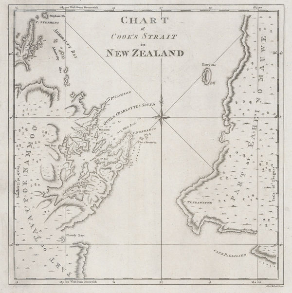
Capt. James Cook, Chart of Cook's Strait in New Zealand, 1773£ 775.00
-
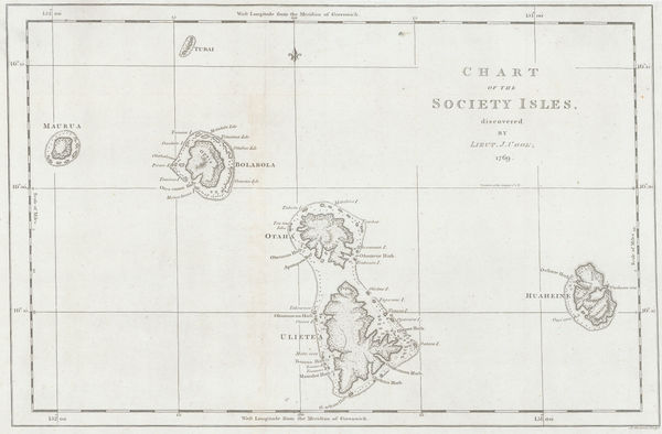
Capt. James Cook, Society Islands, 1773£ 475.00
-
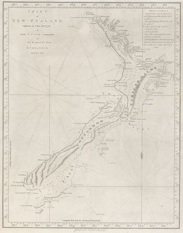
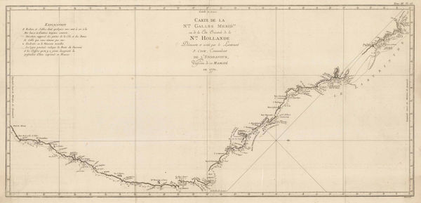
Capt. James Cook, New Zealand, 1773£ 4,950.00
-
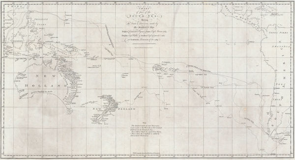
Capt. James Cook, Cook's Discoveries in Australia, New Zealand & the Pacific, 1773£ 1,750.00
-
Capt. James Cook, James Cook's Map of New South Wales & Queensland, 1774£ 1,250.00
-
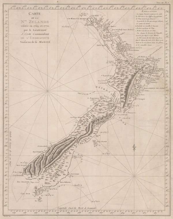
Capt. James Cook, New Zealand, 1774£ 3,750.00
-
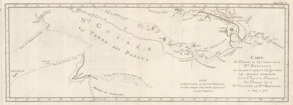
Capt. James Cook, Cook's and Dampier's routes, Papua New Guinea, 1774£ 345.00
-
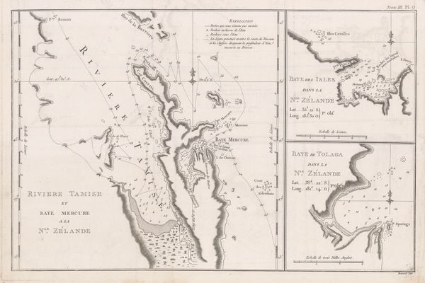
River Thames and Mercury Bay | Bay of Islands | Tolaga Bay in New Zealand, 1774Capt. James CookSeries: LondonCapt. James Cook, River Thames and Mercury Bay | Bay of Islands | Tolaga Bay in New Zealand, 1774£ 625.00
-
Capt. James Cook, Botany Bay and the mouth of the Endeavour River, 1784£ 245.00
-
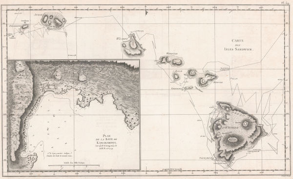
Capt. James Cook, Hawaii, 1785£ 1,850.00
-
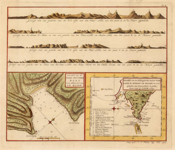
Capt. James Cook, Le Maire Straits, 1794£ 295.00
-
-
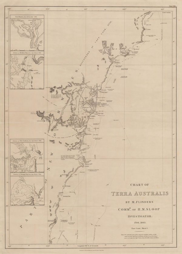
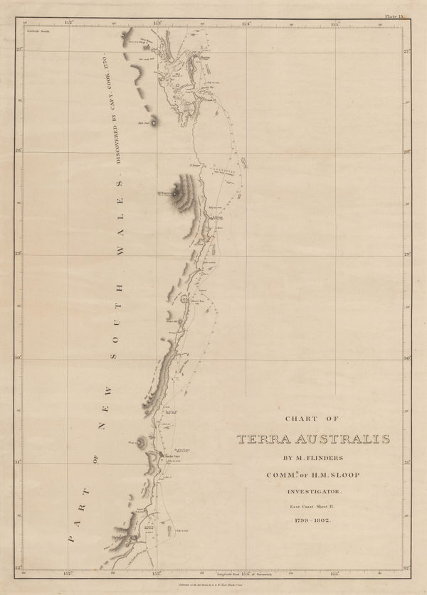
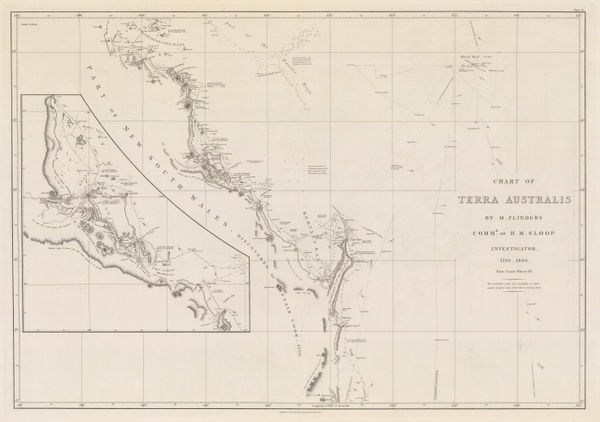
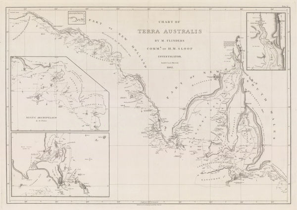
Matthew Flinders, Sea Chart from Brisbane to Port Macquarie, 1814£ 3,500.00
-
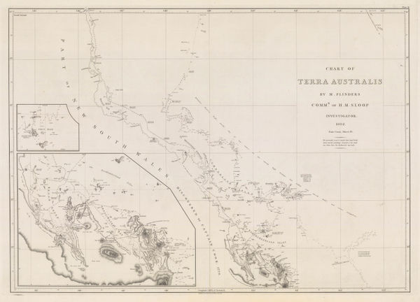
The Coast of Queensland from the Sunshine Coast to Shoalwater Bay, 1814Matthew FlindersSeries: LondonMatthew Flinders, The Coast of Queensland from the Sunshine Coast to Shoalwater Bay, 1814£ 4,500.00
-
Matthew Flinders, The Coast of Queensland from Shoalwater Bay to Cairns, 1814£ 4,500.00
-
Matthew Flinders, The Coast of Queensland from Cairns to Cape Flattery, 1814£ 3,000.00
-
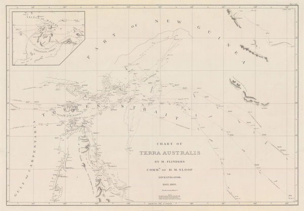
Matthew Flinders, Sea Chart of the Torres Strait, 1814£ 3,500.00
-
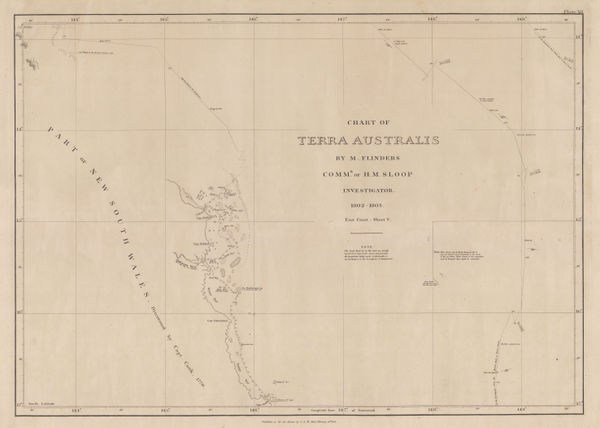
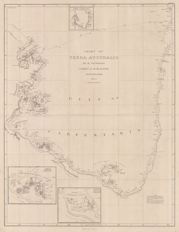
Matthew Flinders, The Gulf of Carpentaria, 1814£ 4,000.00
-
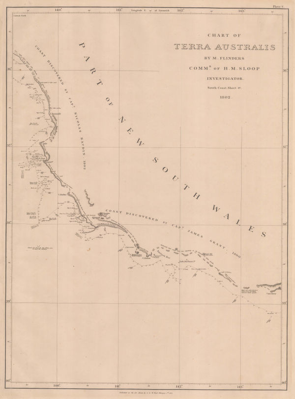
Matthew Flinders, South coast of Western Australia from Cape Leeuwin to Cape Arid, 1814£ 3,500.00
-
-
-
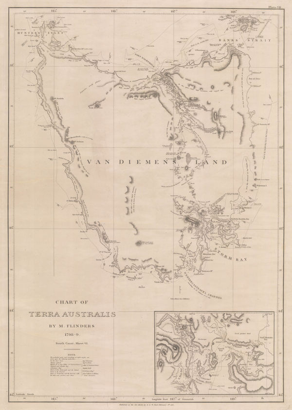
Matthew Flinders, Chart of Tasmania, 1814£ 4,500.00
-
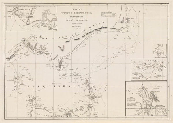
Matthew Flinders, Southern Australian coast from Melbourne to Adelaide, 1814£ 2,500.00
-
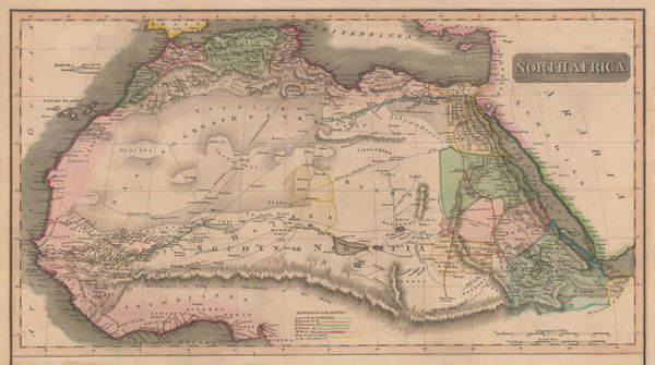
John Thomson, North Africa, 1814£ 315.00
-
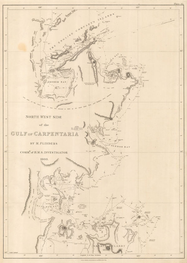
Matthew Flinders, Gulf of Carpentaria, northwest shore, 1814£ 2,000.00
-
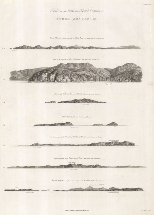
Matthew Flinders, Views of Queensland and the Torres Strait coast, 1814£ 750.00
-
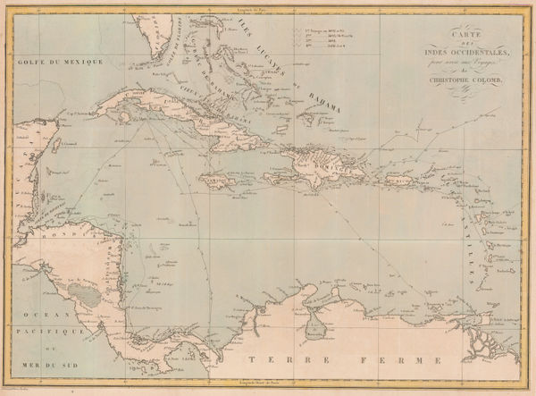
Pierre Tardieu, The Voyages of Christopher Columbus, 1828£ 950.00
-
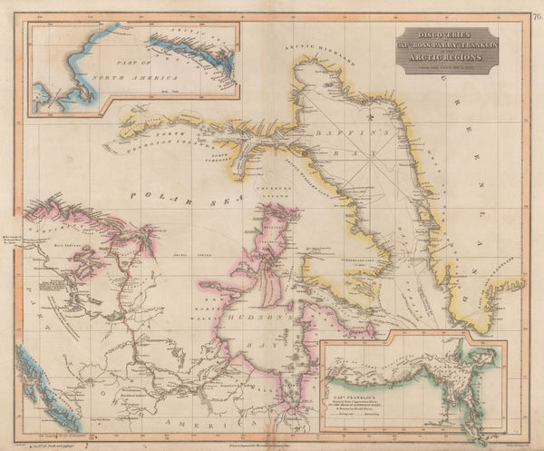
John Thomson, Discoveries of Ross, Parry & Franklin in the Arctic , 1830 c.£ 2,950.00
-
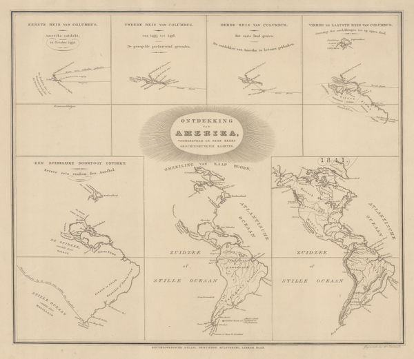
Daniel Veelward, The Discovery of America, 1842£ 350.00
-
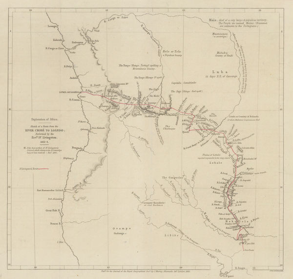
Royal Geographical Society (RGS), Livingstone's route from Botswana to Angola, 1855£ 225.00
-
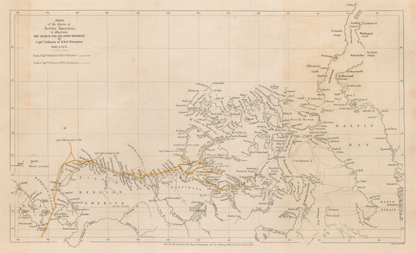
The Northwest Passage and the Search for Sir John Franklin, 1855Royal Geographical Society (RGS)Series: LondonRoyal Geographical Society (RGS), The Northwest Passage and the Search for Sir John Franklin, 1855£ 395.00
-
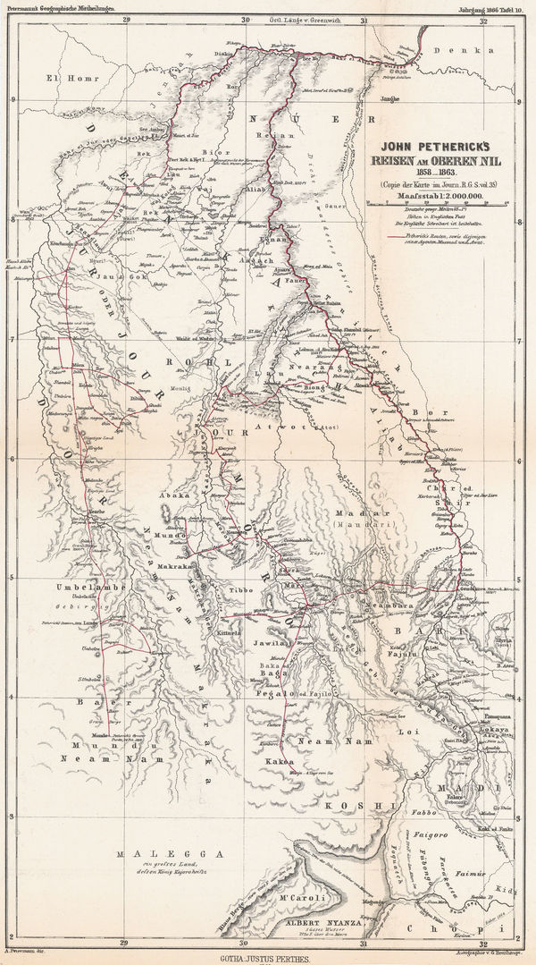
Justus Perthes, Petherick's Exploration of the White Nile, 1866£ 295.00
-
Justus Perthes, Arctic & Antarctic Discoveries, 1868£ 295.00
-
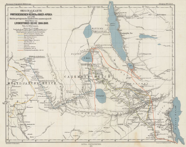
Justus Perthes, Exploration of Zambia, Malawi & Tanzania, 1870£ 78.00
-
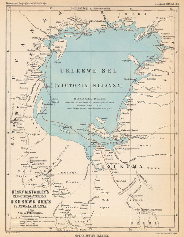
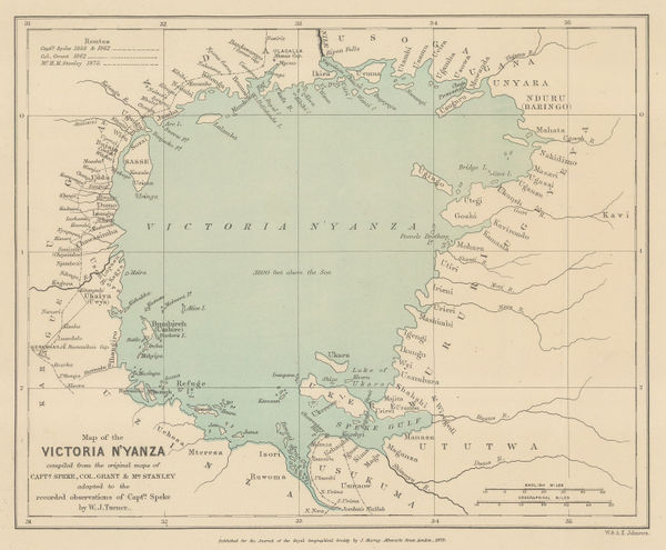
Justus Perthes, Lake Victoria according to Stanley, Speke & Grant, 1875£ 125.00
-
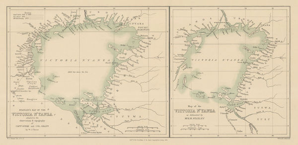
Royal Geographical Society (RGS), Lake Victoria and Uganda, 1876£ 110.00
-
Lake Victoria according to Stanley, Speke & Grant, 1876Royal Geographical Society (RGS)Series: LondonRoyal Geographical Society (RGS), Lake Victoria according to Stanley, Speke & Grant, 1876£ 225.00
-
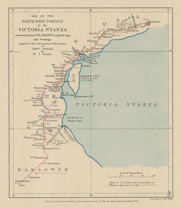
Lake Victoria according to Stanley, Speke & Grant, 1876Royal Geographical Society (RGS)Series: LondonRoyal Geographical Society (RGS), Lake Victoria according to Stanley, Speke & Grant, 1876£ 295.00
-
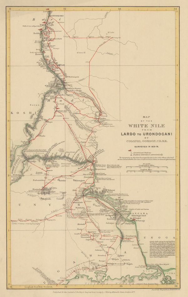
White Nile from Lake Victoria to Gondokoro (Juba), South Sudan, 1877Royal Geographical Society (RGS)Series: LondonRoyal Geographical Society (RGS), White Nile from Lake Victoria to Gondokoro (Juba), South Sudan, 1877£ 145.00
-
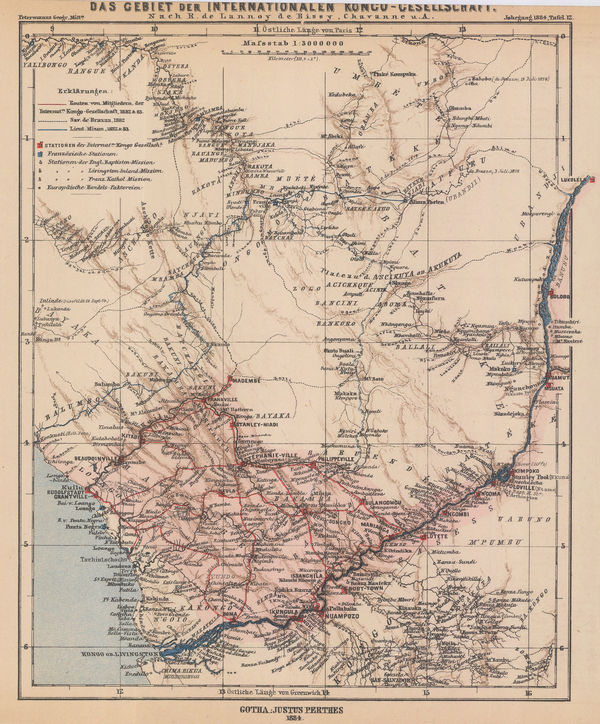
Justus Perthes, Exploration by the International Congo Society, 1884£ 145.00
-
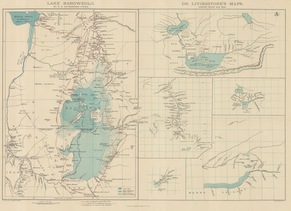
Royal Geographical Society (RGS), Livingstone's maps of Lake Bangweulu, Zimbabwe, 1889£ 145.00
-
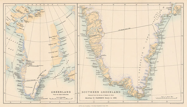
Royal Geographical Society (RGS), Nansen's First Crossing of Greenland, 1889£ 245.00
-
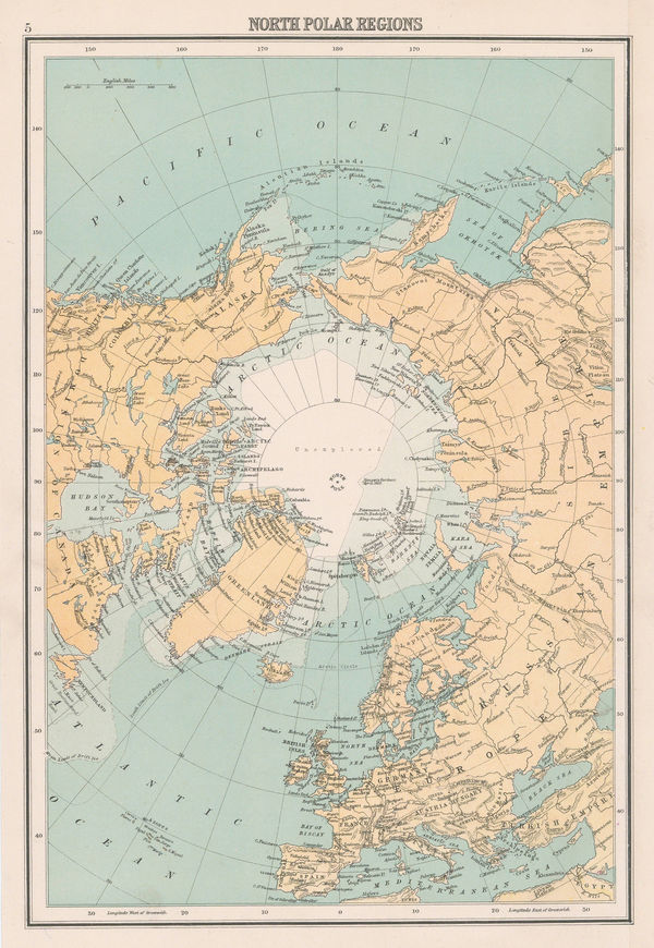
John Bartholomew & Co., North Polar Regions, 1900 (c.)£ 95.00
-
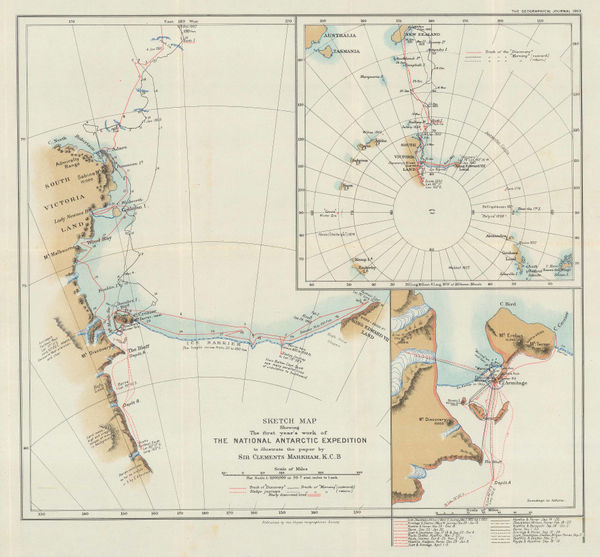
Sketch Map Showing the First Year's Work of The National Antarctic Exhibition, 1903Royal Geographical Society (RGS)Series: LondonRoyal Geographical Society (RGS), Sketch Map Showing the First Year's Work of The National Antarctic Exhibition, 1903£ 1,650.00
-
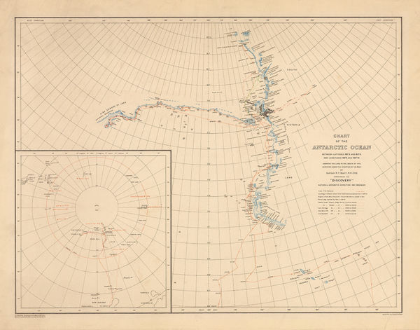
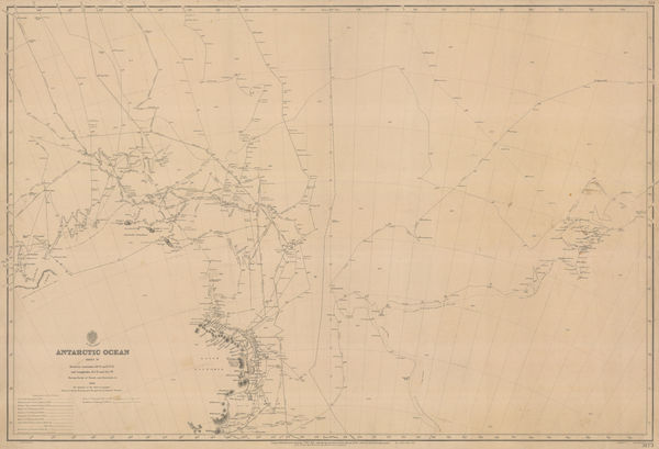
George F. A. Mulock, Chart of the Antarctic Ocean, 1904£ 1,750.00
-
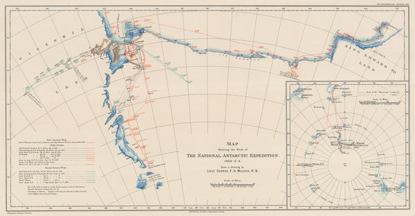
Map Showing the Work of The National Antarctic Expedition 1902-03-04, 1904Royal Geographical Society (RGS)Series: LondonRoyal Geographical Society (RGS), Map Showing the Work of The National Antarctic Expedition 1902-03-04, 1904£ 2,950.00
-
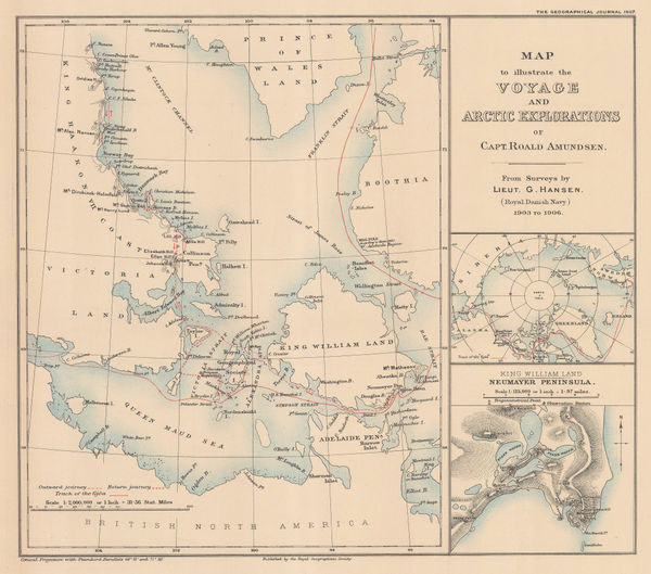
Roald Amundsen's Gjøa Expedition through the Northwest Passage, 1907Royal Geographical Society (RGS)Series: LondonRoyal Geographical Society (RGS), Roald Amundsen's Gjøa Expedition through the Northwest Passage, 1907£ 395.00
-
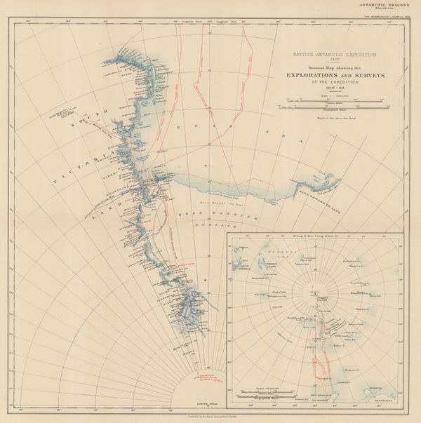
Royal Geographical Society (RGS), Shackleton's British Antarctic Expedition, 1909£ 2,200.00
-
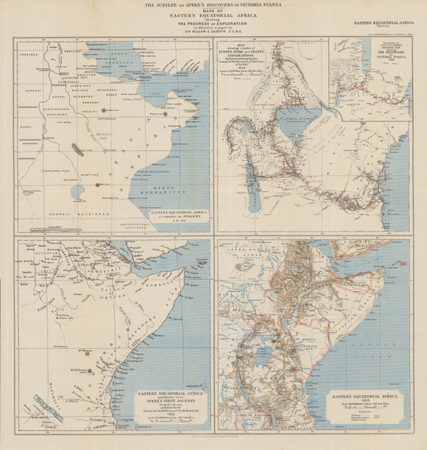
The Jubilee of Speke's Discovery of Victoria Nyanza, 1909Royal Geographical Society (RGS)Series: LondonRoyal Geographical Society (RGS), The Jubilee of Speke's Discovery of Victoria Nyanza, 1909£ 425.00
-
British Admiralty, Antarctic Ocean Sheet IV, 1910£ 3,500.00
-
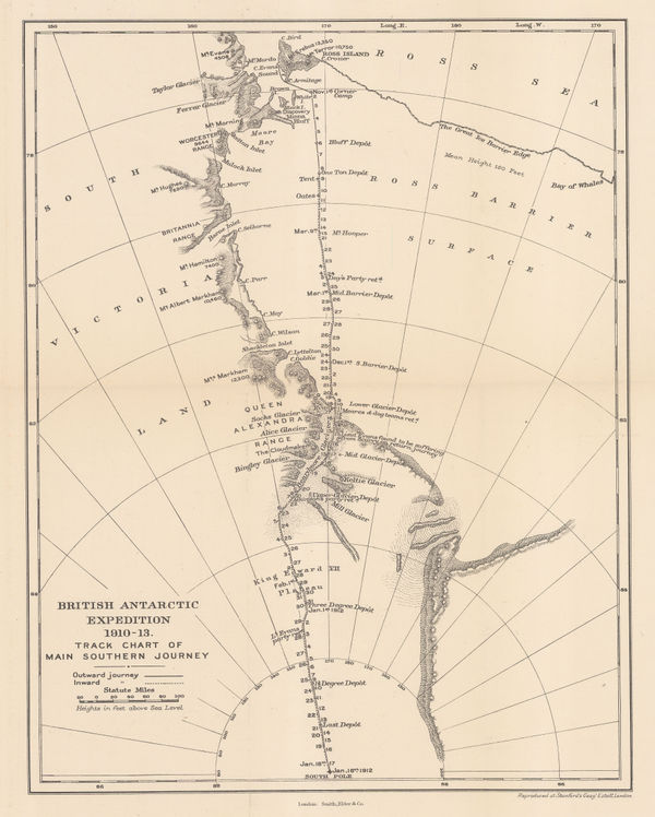
British Antarctic Expedition 1910-13. Track chart of the main southern journey, 1913Edward StanfordSeries: LondonEdward Stanford, British Antarctic Expedition 1910-13. Track chart of the main southern journey, 1913£ 450.00
-
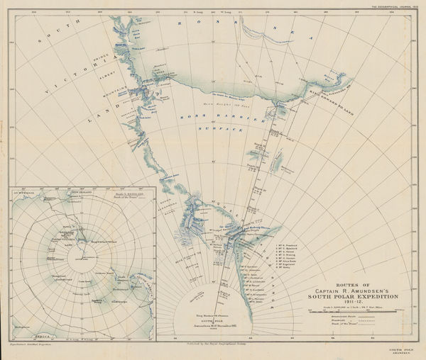
Routes of Captain R. Amundsen's South Polar Expedition 1911-1912, 1913Royal Geographical Society (RGS)Series: LondonRoyal Geographical Society (RGS), Routes of Captain R. Amundsen's South Polar Expedition 1911-1912, 1913£ 4,950.00
-
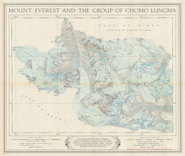
Ordnance Survey, Mount Everest and the Group of Chomo Lungma, 1934£ 1,500.00
-
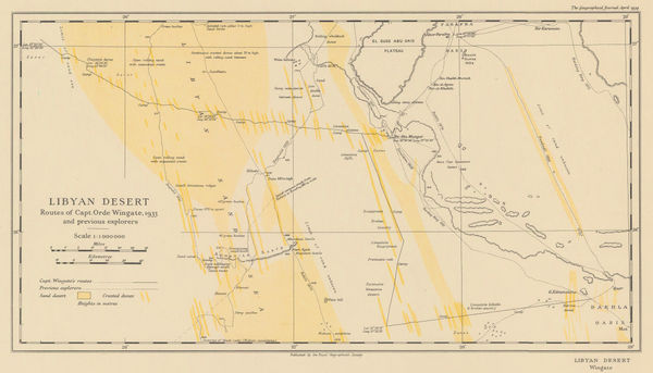
Royal Geographical Society (RGS), Orde Wingate's Egypt Expedition, 1934£ 175.00
-
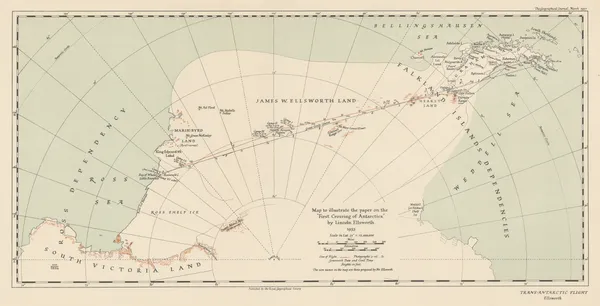
Royal Geographical Society (RGS), The "First Crossing of Antarctica", 1937£ 650.00
Noted Explorers
Our entire inventory of over 10,000 antique and vintage maps is now available to browse by region, date, cartographer, and subject