-

-
-
Willem & Jan Blaeu, North eastern Canada, Newfoundland and southern Greenland, 1662£ 3,950.00
-
Vincenzo Coronelli, Eastern Canada and Newfoundland, 1695£ 2,150.00
-
Pierre Mortier, Eastern Canada and Hudson Bay, 1700£ 4,450.00
-
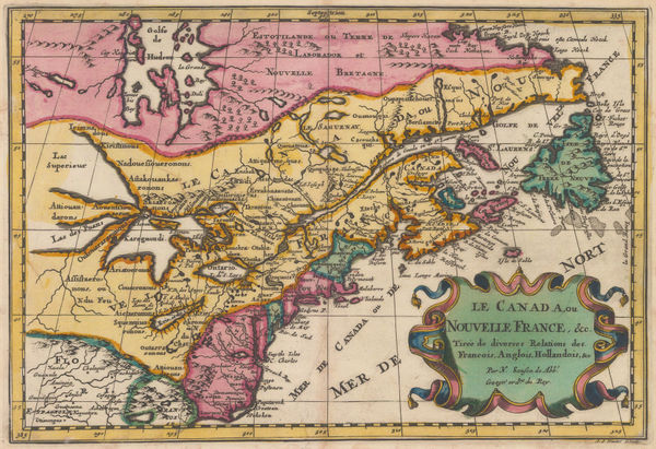
Nicolas & Guillaume Sanson, Early map of eastern Canada , 1700£ 1,250.00
-
-
-
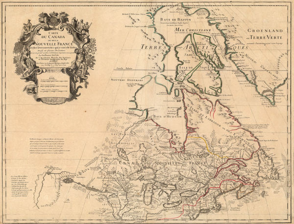
Guillaume De L'Isle, Eastern Canada, 1718 c.£ 2,450.00
-
Covens (Jean) & Mortier (Cornelius), Eastern North America, 1730 c.£ 895.00
-
Jacques-Nicolas Bellin, Eastern Canada, Nova Scotia and Newfoundland, 1744£ 1,250.00
-
Homann Heirs, Newfoundland, Quebec, Nova Scotia and New Brunswick, 1755£ 1,150.00
-
Tobias Conrad Lotter, Eastern Canada, 1755 c.£ 2,200.00
-
Jacques-Nicolas Bellin, St. Lawrence River from Quebec to Lake Ontario, 1757£ 325.00
-
Mount & Page, New Foundland to Hudson's Bay, 1760 c.£ 925.00
-
-
Andrew Dury, Canada, 1763£ 325.00
-
Andrea Scacciati, Gulf of St. Lawrence, 1763£ 445.00
-
Veremondo Rossi, Newfoundland, 1763£ 345.00
-
Jacques-Nicolas Bellin, Canada & New England, 1764£ 495.00
-
Isaac Tirion, Plan of the Battle of Quebec, 1765£ 845.00
-
Isaac Tirion, Eastern Canada, 1769£ 495.00
-
Northwestern USA, Eastern Russia and the North Pacific, 1770 c.Johann Heinrich HeideggerSeries: ZurichJohann Heinrich Heidegger, Northwestern USA, Eastern Russia and the North Pacific, 1770 c.£ 795.00
-
Robert de Vaugondy, Carte des Parties Nord et Ouest de l'Amerique, 1772£ 695.00
-
Thomas Jefferys, Chart of the St Lawrence River, 1775£ 1,250.00
-
William Guthrie, A General Map of North America from the best Authorities, 1792£ 295.00
-
John Wilkes, British Colonies in North America, 1797£ 175.00
-
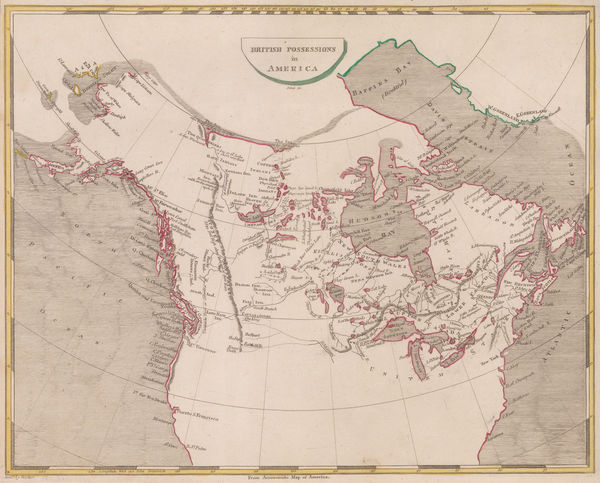
Thomas and Andrews, British Possessions in America, 1805£ 295.00
-
John Russell, British Colonies in North America, 1805 c.£ 115.00
-
Aaron Arrowsmith, British Possessions in North America, 1809£ 345.00
-
Neele, Map of Canada, 1809£ 485.00
-
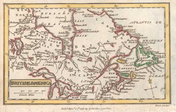
Richard Phillips, Eastern Canada, 1813£ 58.00
-
John Thomson, Canada and Nova Scotia, 1816£ 985.00
-
Thomas Myers, Alexander Mackenzie's journeys to the Arctic and Pacific coasts, 1821£ 145.00
-
Geographical, Statistical and Historical map of Upper and Lower Canada, 1822Carey & LeaSeries: PhiladelphiaCarey & Lea, Geographical, Statistical and Historical map of Upper and Lower Canada, 1822£ 925.00
-
Philippe Vandermaelen, Gulf of St. Lawrence, 1827£ 150.00
-
Thomas Starling, Miniature map of Canada, 1830 c.£ 88.00
-
Thomas Starling, Canada, 1830 c.£ 48.00
-
Sidney Hall, Canada, New Brunswick and Nova Scotia, 1830 c.£ 525.00
-
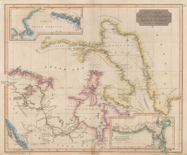
John Thomson, Discoveries of Ross, Parry & Franklin in the Arctic , 1830 c.£ 2,950.00
-
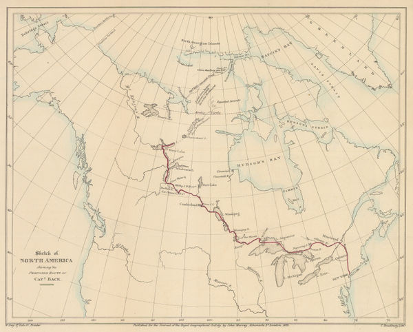
Royal Geographical Society (RGS), Captain Black's proposed route through Canada, 1833£ 145.00
-
Charles Smith, Upper and Lower Canada, 1834£ 225.00
-
Thomas Bradford, Upper & Lower Canada, 1835£ 55.00
-
James Wyld, A Map of the Province of Upper Canada, 1840 c.£ 925.00
-
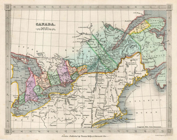
Thomas Kelly, Canada, 1840 c.£ 85.00
-
Joseph Meyer, Quebec Province, 1844£ 88.00
-
Henry Teesdale, Canada, New Brunswick and Nova Scotia, 1845£ 185.00
-
George Frederick Cruchley, North America, 1845£ 120.00
-
Joseph Meyer, Bergsystem von Nord-America, 1848£ 295.00
-
Samuel Augustus Mitchell, Quebec Province, 1850£ 90.00
-
Peter Jackson, Eastern Canada, 1850 c.£ 68.00
-
Joshua Archer, Canada, New Brunswick, Nova Scotia etc., 1850 c.£ 55.00
-
John Tallis, Canada, New Brunswick, 1851£ 235.00
-
John Arrowsmith, British North America, 1852£ 895.00
-
Royal Geographical Society (RGS), Route map of Canada, 1852£ 325.00
-
George Matthews, Railway map of Quebec and Ontario, 1853£ 195.00
-
Joseph Hutchins Colton, Canada East or Lower Canada and New Brunswick, 1855£ 95.00
-
Joseph Meyer, Canada, Alaska and Greenland, 1855 c.£ 165.00
-
George Philip, Canada, Nova Scotia & New Brunswick &c., 1856£ 220.00
-
East Canada and New Brunswick, 1860 c.Society for the Diffusion of Useful Knowledge (SDUK)Series: LondonSociety for the Diffusion of Useful Knowledge (SDUK), East Canada and New Brunswick, 1860 c.£ 95.00
-
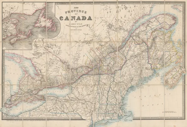
James Wyld, The Province of Canada, 1860 c.£ 1,450.00
-
Justus Perthes, The Coast of Labrador, 1861£ 88.00
-
Joseph Hutchins Colton, Canada, Alaska & Greenland, 1861£ 195.00
-
James Cowles Prichard, Ethnographic Map of North America, 1861£ 550.00
-
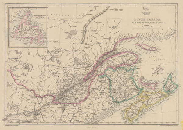
Edward Weller, Lower Canada, New Brunswick, Nova Scotia, 1863£ 45.00
-
Johnson & Ward, Ontario and Quebec, 1863 c.£ 150.00
-
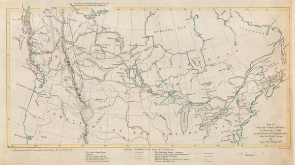
Sketch Map Showing Proposed Communication Between Canada & British Columbia, 1868Royal Geographical Society (RGS)Series: LondonRoyal Geographical Society (RGS), Sketch Map Showing Proposed Communication Between Canada & British Columbia, 1868£ 58.00
-
John Dower, Canada &c., 1870 c.£ 78.00
-
Archibald Fullarton, Canada with part of the United States, 1870 c.£ 125.00
-
William Collins, Dominion of Canada, 1877 c£ 95.00
-
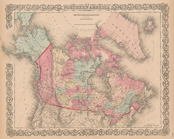
Society for the Diffusion of Useful Knowledge (SDUK), Dominion of Canada, 1880 c.£ 345.00
-
Letts & Son, Statistical Map of the Dominions of Canada, 1883£ 165.00
-
Henry Cuthbert Tunison, Ontario & Quebec, 1885£ 275.00
-
George W. Bacon, Ontario and the Great Lakes, 1885 (c.)£ 345.00
-
George W. Bacon, Canada, 1885 (c.)£ 225.00
-
J.G. Bartholomew, Dominion of Canada, 1887£ 56.00
-
Scottish Geographical Society (SGS), Map of the Labrador Peninsula, 1895£ 325.00
-
Edward Stanford, Ontario, Quebec, New Brunswick & Nova Scotia, 1896£ 95.00
-
Edward Stanford, Canada, 1896£ 85.00
-
The North-Western Part of the Dominion of Canada, 1898Royal Geographical Society (RGS)Series: LondonRoyal Geographical Society (RGS), The North-Western Part of the Dominion of Canada, 1898£ 495.00


Page
1
of 2