-
 Selina Hall, United States, 1850 c.£ 275.00
 -
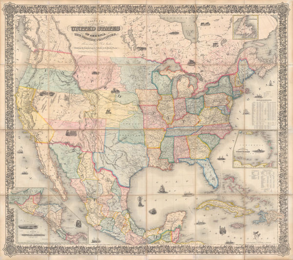
John Tallis, United States, 1851£ 495.00
-
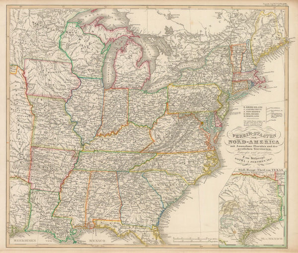
Justus Perthes, Eastern United States, 1851£ 125.00
-
Joseph Meyer, Neueste Karte von Maryland und Delaware, 1851£ 295.00
-
John Tallis, Boston, 1851£ 975.00
-
Benedetto Marzolla, Nuova California, 1851£ 2,200.00
-
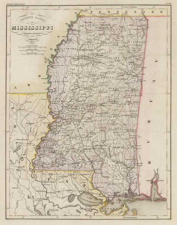
Joseph Meyer, Mississippi, 1852£ 245.00
-
Edward Hitchcock, A Geological Map of the United States and Canada, 1853£ 985.00
-
Charles V. Monin, United States, 1853£ 82.00
-
Map of Passes in the Sierra Nevada, 1853United States Pacific Railroad Expeditions (USPRR)Series: Washington, D.C.United States Pacific Railroad Expeditions (USPRR), Map of Passes in the Sierra Nevada, 1853£ 575.00
-
Joseph Meyer, Geological Map of the United States, 1853£ 475.00
-
-
A Plat Exhibiting the State of the Surveys in the State of Florida, 1854General Land Office (GLO)Series: St. AugustineGeneral Land Office (GLO), A Plat Exhibiting the State of the Surveys in the State of Florida, 1854£ 985.00
-
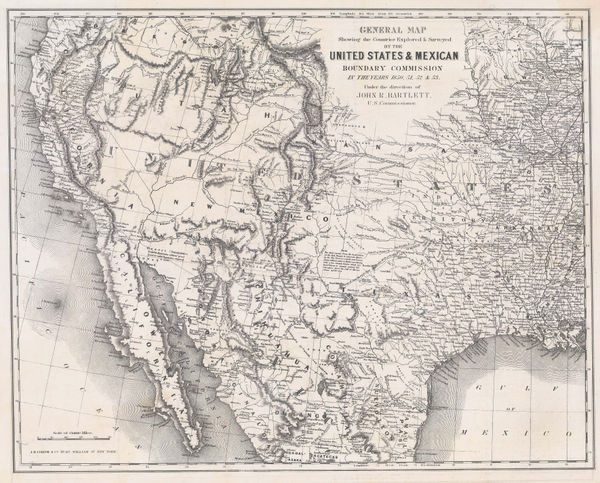
General Map Showing the Countries Explored and Surveyed by the United States & Mexican Boundary Commission, 1854John BartlettSeries: New YorkJohn Bartlett, General Map Showing the Countries Explored and Surveyed by the United States & Mexican Boundary Commission, 1854£ 950.00
-
Alexander Dallas Bache, Preliminary Chart of Plymouth Harbor, 1854£ 125.00
-
George Woolworth Colton, Alabama, 1855£ 120.00
-
George Woolworth Colton, Arkansas, 1855£ 150.00
-
George Woolworth Colton, Colton's New Hampshire, 1855£ 85.00
-
From Fort Smith to the Rio Grande, 1855United States Pacific Railroad Expeditions (USPRR)Series: Washington, D.C.United States Pacific Railroad Expeditions (USPRR), From Fort Smith to the Rio Grande, 1855£ 1,150.00
-
From the Valley of Green River to the Great Salt Lake, 1855United States Pacific Railroad Expeditions (USPRR)Series: Washington, D.C.United States Pacific Railroad Expeditions (USPRR), From the Valley of Green River to the Great Salt Lake, 1855£ 585.00
-
Geological Map of the Mississippi River to the Pacific Ocean, 1855United States Pacific Railroad Expeditions (USPRR)Series: Washington, D.C.United States Pacific Railroad Expeditions (USPRR), Geological Map of the Mississippi River to the Pacific Ocean, 1855£ 775.00
-
Geological Section from the Mississippi River to the Pacific Ocean, 1855United States Pacific Railroad Expeditions (USPRR)Series: Washington, D.C.United States Pacific Railroad Expeditions (USPRR), Geological Section from the Mississippi River to the Pacific Ocean, 1855£ 675.00
-
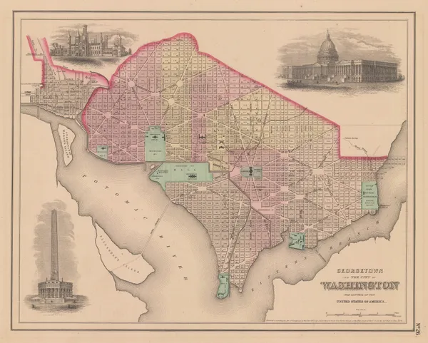
Joseph Hutchins Colton, Georgetown and the City of Washington, 1855£ 445.00
-
Joseph Hutchins Colton, Iowa, 1855£ 165.00
-
George Woolworth Colton, Kentucky and Tennessee, 1855£ 125.00
-
Joseph Hutchins Colton, Lake Superior and the Northern Part of Michigan, 1855£ 185.00
-
Joseph Hutchins Colton, Maine, 1855£ 195.00
-
Map No. 2 - From Great Salt Lake to the Humboldt Mountains, 1855United States Pacific Railroad Expeditions (USPRR)Series: Washington, D.C.United States Pacific Railroad Expeditions (USPRR), Map No. 2 - From Great Salt Lake to the Humboldt Mountains, 1855£ 425.00
-
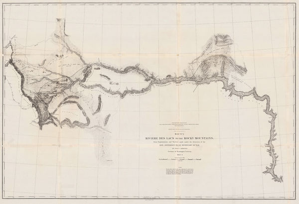
Map No. 2 - Riviere des Lacs to the Rocky Mountains, 1855United States Pacific Railroad Expeditions (USPRR)Series: Washington, D.C.United States Pacific Railroad Expeditions (USPRR), Map No. 2 - Riviere des Lacs to the Rocky Mountains, 1855£ 825.00
-
Map No. 3 - From the Humboldt Mountains to the Mud Lakes, 1855United States Pacific Railroad Expeditions (USPRR)Series: Washington, D.C.United States Pacific Railroad Expeditions (USPRR), Map No. 3 - From the Humboldt Mountains to the Mud Lakes, 1855£ 385.00
-
Map No. 4 - From The Coo-Che-To-Pa Pass to the Wahsatch Mountains, 1855United States Pacific Railroad Expeditions (USPRR)Series: Washington, D.C.United States Pacific Railroad Expeditions (USPRR), Map No. 4 - From The Coo-Che-To-Pa Pass to the Wahsatch Mountains, 1855£ 595.00
-
Map No.3 - From the Santa Fe Crossing to the Coo Che To Pa Pass, 1855United States Pacific Railroad Expeditions (USPRR)Series: Washington, D.C.United States Pacific Railroad Expeditions (USPRR), Map No.3 - From the Santa Fe Crossing to the Coo Che To Pa Pass, 1855£ 525.00
-
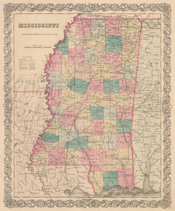
George Woolworth Colton, Mississippi, 1855£ 85.00
-
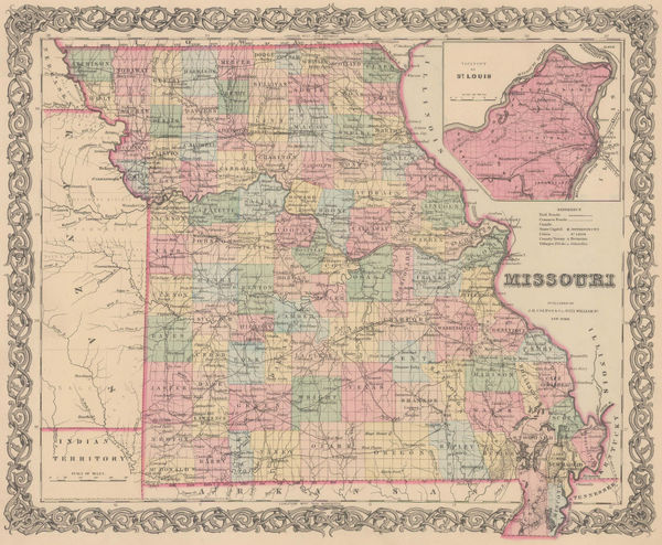
George Woolworth Colton, Missouri, 1855£ 88.00
-
George Woolworth Colton, New Jersey, 1855£ 195.00
-
Joseph Hutchins Colton, Pennsylvania, 1855£ 185.00
-
Joseph Hutchins Colton, Pittsburgh and Cincinnati, 1855£ 88.00
-
William P. Blake, Geological Map of California, 1855£ 795.00
-
A New Map for Travellers through the United States of America showing the Railways Canals and Stage Roads, 1855 c.George Philip & Son Ltd.Series: LiverpoolGeorge Philip & Son Ltd., A New Map for Travellers through the United States of America showing the Railways Canals and Stage Roads, 1855 c.£ 1,250.00
-
A. & C. Black, Maine, 1856£ 68.00
-
David H. Burr, Map Showing the Surveys in the Territory of Utah, 1856£ 1,550.00
-
Morse & Gaston, Arkansas, 1857£ 32.00
-
Carl Flemming, California, Oregon, Utah and New Mexico, 1857£ 395.00
-
Morse & Gaston, Connecticut, Rhode Island, and Long Island, 1857£ 38.00
-
Morse & Gaston, Kentucky and Tennessee, 1857£ 36.00
-
Morse & Gaston, Maine, 1857£ 36.00
-
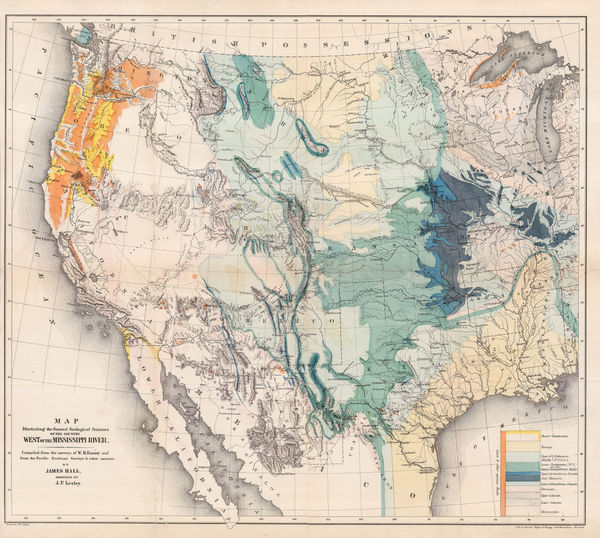
Map Illustrating the General Geological features of the Country West of the Mississippi River, 1857James HallSeries: Washington, D.C.James Hall, Map Illustrating the General Geological features of the Country West of the Mississippi River, 1857£ 1,350.00
-
Map of the State of Florida Showing the Progress of the Surveys, 1857General Land Office (GLO)Series: PhiladelphiaGeneral Land Office (GLO), Map of the State of Florida Showing the Progress of the Surveys, 1857£ 425.00
-
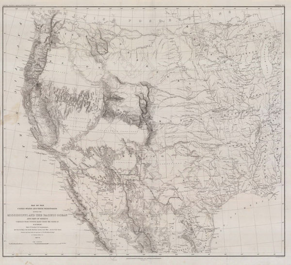
Map of the Unites States and their Territories between the Mississippi and the Pacific Ocean, 1857William Hemsley EmorySeries: Washington, D.C.William Hemsley Emory, Map of the Unites States and their Territories between the Mississippi and the Pacific Ocean, 1857£ 850.00
-
Alexander Dallas Bache, St. Mary's River and Fernandina Harbour, 1857£ 275.00
-
Morse & Gaston, Vermont & New Hampshire, 1857£ 36.00
-
Morse & Gaston, Wisconsin, 1857£ 32.00
-
Joseph Hutchins Colton, Map of New York with Adjacent Cities, 1857£ 825.00
-
George Woolworth Colton, Kansas and Nebraska, 1857 c.£ 185.00
-
Joseph Christmas Ives, Rio Colorado of the West, 1858£ 1,250.00
-
Joseph Christmas Ives, Rio Colorado of the West, 1858£ 1,250.00
-
Justus Perthes, Great Salt Lake and Utah Lake, 1858£ 88.00
-
Alexander Dallas Bache, Port Royal Entrance, 1859£ 125.00
-
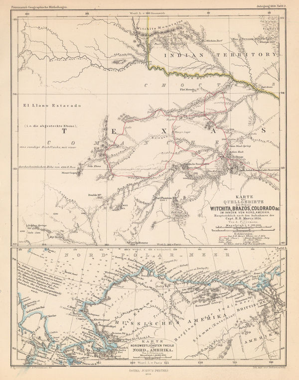
Justus Perthes, North Texas & Alaska, 1859£ 125.00
-
Henry Francis Walling, A New Map of the Vicinity of Boston, 1860£ 950.00
-
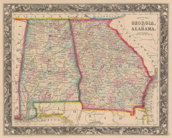
Samuel Augustus Mitchell, County Map of Georgia and Alabama, 1860£ 145.00
-
Samuel Augustus Mitchell, County Map of Kentucky and Tennessee, 1860£ 95.00
-
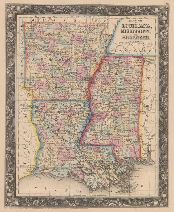
Samuel Augustus Mitchell, County Map of Louisiana, Mississippi and Arkansas, 1860£ 145.00
-
Samuel Augustus Mitchell, County Map of Ohio and Indiana, 1860£ 125.00
-
Map Showing the Routes travelled by the Command of Maj. E. Steen U.S. Dragn., 1860Lt. Joseph DixonSeries: Washington, D.C.Lt. Joseph Dixon, Map Showing the Routes travelled by the Command of Maj. E. Steen U.S. Dragn., 1860£ 750.00
-
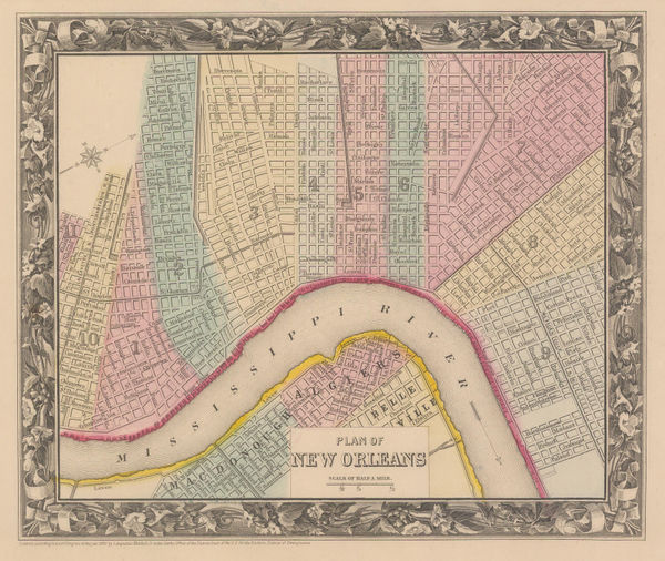
Samuel Augustus Mitchell, Plan of New Orleans, 1860£ 225.00
-
Samuel Augustus Mitchell, Plan of Philadelphia, 1860£ 225.00
-
Samuel Augustus Mitchell, County Map of Texas, 1860£ 495.00
-
D.T. Valentine, Map of the City & County of New York, 1860£ 875.00
-
James Miller, New York City Map, 1860 (c.)£ 1,150.00
-
Society for the Diffusion of Useful Knowledge (SDUK), New York, 1860 c.£ 595.00
-
Archibald Fullarton, New York Harbour and Vicinity, 1860 c.£ 85.00
-
Archibald Fullarton, Oregon and California, 1860 c.£ 265.00
-
Archibald Fullarton, Providence, 1860 c.£ 36.00
-
John Dower, Eastern United States, 1860 c.£ 120.00
-
Daniel & William Lizars, Eastern USA and the Caribbean, 1860 c.£ 350.00
-
Archibald Fullarton, United States - North America, 1860 c.£ 245.00
-
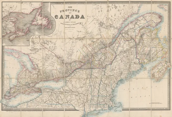
James Wyld, The Province of Canada, 1860 c.£ 1,450.00
-
US Government, Ceded Part of Dakota Territory, 1861£ 195.00
-
James T. Lloyd, American Railroad Map, 1861£ 2,750.00


Page
7
of 16